Photographs mostly of rocks on Arran, Scotland
© Charles Warner 31 July 2015 edition
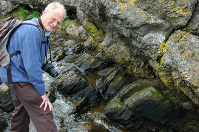
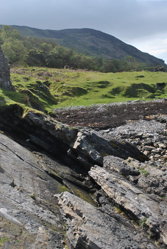
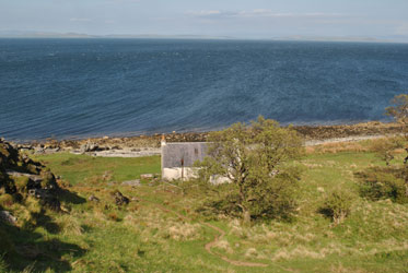
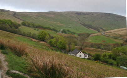
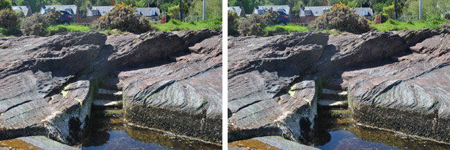
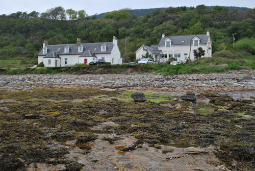
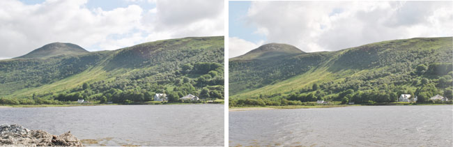 Cottages southeast of Lochranza, photographed near the
deer, with Left eye at National Grid Reference NR 937 508 and
Right eye roughly 70 m to the northwest. There is some "fur" in the stereo due to change in
illumination of Meall Mòr (496 m), 2.5 km to the south. 8 July 15.
Cottages southeast of Lochranza, photographed near the
deer, with Left eye at National Grid Reference NR 937 508 and
Right eye roughly 70 m to the northwest. There is some "fur" in the stereo due to change in
illumination of Meall Mòr (496 m), 2.5 km to the south. 8 July 15.
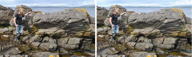
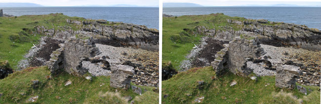
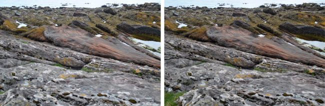
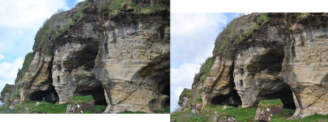
 According to
David Tyler, Hutton's Unconformity
on Arran involves rocks of provenance similar to those of the unconformity at
Siccar Point. On the right in
this view, Dalradian schists (of age say ~420 Ma) occur in layers tilted downwards at ~40-50° to the SSW.
On the left, layers of Upper Old Red Sandstone (~365 Ma) dip downwards at ~30° to the NNW. Here
Atsumu Ohmura studies the unconformity on 20 May 13,
at National Grid Reference NR 936 521.
According to
David Tyler, Hutton's Unconformity
on Arran involves rocks of provenance similar to those of the unconformity at
Siccar Point. On the right in
this view, Dalradian schists (of age say ~420 Ma) occur in layers tilted downwards at ~40-50° to the SSW.
On the left, layers of Upper Old Red Sandstone (~365 Ma) dip downwards at ~30° to the NNW. Here
Atsumu Ohmura studies the unconformity on 20 May 13,
at National Grid Reference NR 936 521.
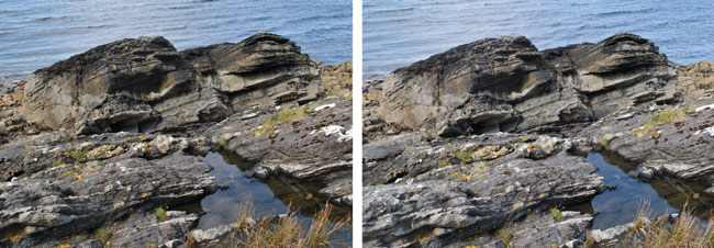
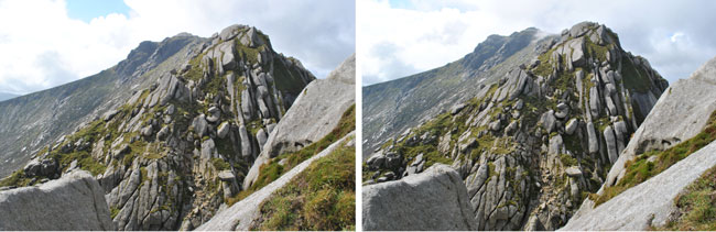
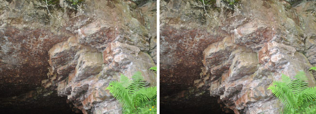
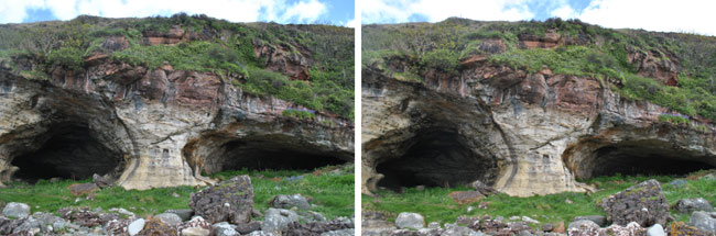
 At top right in both of these stereos, looking southwestwards, the layers of Upper Old Red Sandstone dip downwards
and to the right at ~30° to the NNW. Below, the Dalradian schists are seen tilted
downwards to the left at ~45° to the SSW.
At top right in both of these stereos, looking southwestwards, the layers of Upper Old Red Sandstone dip downwards
and to the right at ~30° to the NNW. Below, the Dalradian schists are seen tilted
downwards to the left at ~45° to the SSW.
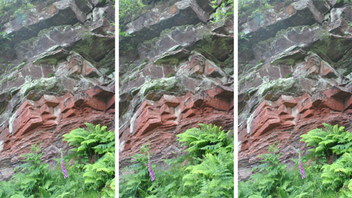
 My eyes are level with the Unconformity - photographed by Atsumu Ohmura on 20 May 13.
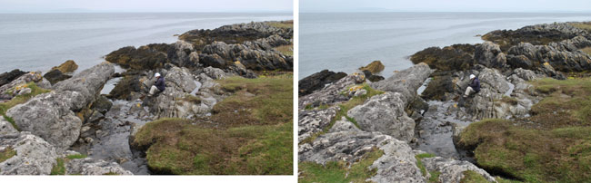
 Here on 21 August 12 I met Phillip Holmes, geologist, his wife Sarah Jane and son Sam.
Sam found me a rock with clasts stuffed into a sandy matrix, typical of the crushing and
grinding which occurred here.
Here on 21 August 12 I met Phillip Holmes, geologist, his wife Sarah Jane and son Sam.
Sam found me a rock with clasts stuffed into a sandy matrix, typical of the crushing and
grinding which occurred here.
 Walking eastwards in May 2013, we found sandstone near the Cock of Arran (here inspected by Gerd Ragette);
and Ossian's Cave (?) at NR 933 517. (back)
Walking eastwards in May 2013, we found sandstone near the Cock of Arran (here inspected by Gerd Ragette);
and Ossian's Cave (?) at NR 933 517. (back)
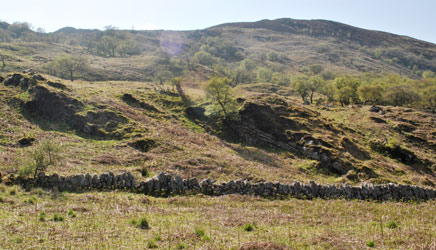
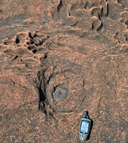
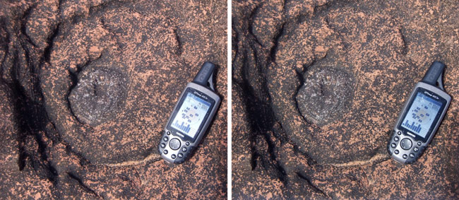
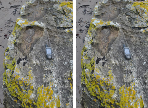
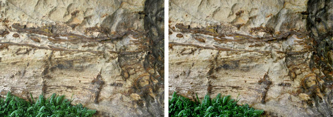
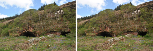
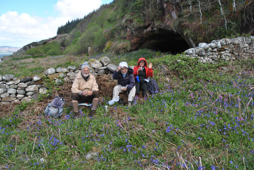
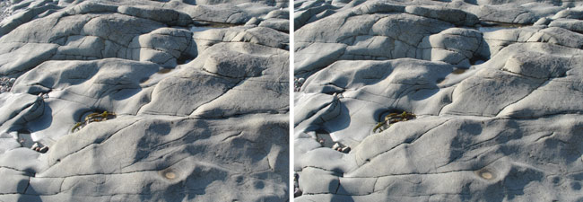
At a ruined settlement near Laggan ...
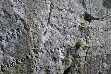
 a Myriapod
trail may be discerned extending several metres across an outcrop of sandstone. The photo on the right
shows other interesting markings. The location is NR 9722 5117. The GPS is 15.6 cm long. The
Hunterian Museum in Glasgow has a model of this trail.
a Myriapod
trail may be discerned extending several metres across an outcrop of sandstone. The photo on the right
shows other interesting markings. The location is NR 9722 5117. The GPS is 15.6 cm long. The
Hunterian Museum in Glasgow has a model of this trail.
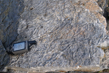
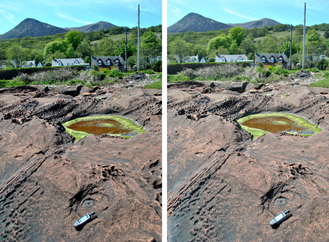
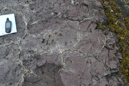
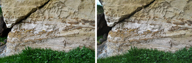
Layers at Laggan akin to those showing the fossil tracks
 From the cottage at Laggan at NR 978 508 we ascended the trail westwards past Creag Ghlas Laggan over the top
of the ridge at 260 m, with fine views on the descent back to Lochranza and Newton Point near
Hutton's Unconformity:-
From the cottage at Laggan at NR 978 508 we ascended the trail westwards past Creag Ghlas Laggan over the top
of the ridge at 260 m, with fine views on the descent back to Lochranza and Newton Point near
Hutton's Unconformity:-
Tor Nead an Eoin (325 m)
Glen Chalmadale. The A841 road ascending from Lochranza is seen at right.
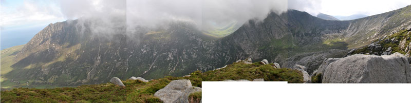
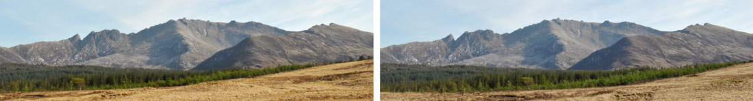 Panorama looking southwards across North Glen Sannox at Goat Fell et al. from the A841 road at NR 972 485
on 25 May 13, using a baseline of ~42 m. The ridge line in the middle of this view descends from "Hill 634" and
Ceum na Caillich which I ascended in 2012 (see below); next to the right is Casteal Abhail (859 m), distant 4.3 km.
Closer to the camera were Creag Dhubh and Carn Mor. Seen here to the left, Goat Fell (874 m), to the southwest, is
distant 7 km and appears lower on the horizon.
Panorama looking southwards across North Glen Sannox at Goat Fell et al. from the A841 road at NR 972 485
on 25 May 13, using a baseline of ~42 m. The ridge line in the middle of this view descends from "Hill 634" and
Ceum na Caillich which I ascended in 2012 (see below); next to the right is Casteal Abhail (859 m), distant 4.3 km.
Closer to the camera were Creag Dhubh and Carn Mor. Seen here to the left, Goat Fell (874 m), to the southwest, is
distant 7 km and appears lower on the horizon.
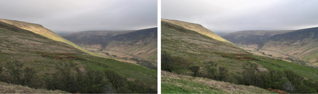
 The usual route up to Cir Mhor and Goatfell on Arran is from the south up Glen Rosa. Naively in 2012 I tried
to climb Cir Mhor by walking up through the forest of North Glen Sannox and up on the right hand side of
the spur seen in the panorama above. On this north side a nice path through the big wet grassy tufts has
not been made.
The usual route up to Cir Mhor and Goatfell on Arran is from the south up Glen Rosa. Naively in 2012 I tried
to climb Cir Mhor by walking up through the forest of North Glen Sannox and up on the right hand side of
the spur seen in the panorama above. On this north side a nice path through the big wet grassy tufts has
not been made.
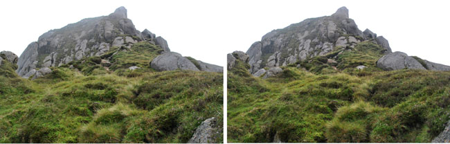
 The granite rocks of the outlying Ceum na Caillich. They have been weathered to smooth round shapes.
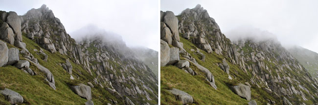
A 10 metre drop barred the way to Caisteal Abhail ....
... so I stopped and looked southeastwards across Glen Sannox towards north Goatfell before retreating.
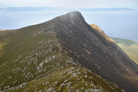
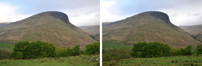
This outlying peak to the northeast I call Hill 634 m.
 Close to the A841 road as it descends eastwards towards Sannox, at NR 994 468, an exposure of pale
greenish-blue pillow lavas from the Ordovician period (488-433 Ma) may be found (See the leaflet
"Isle of Arran Trails Geology" by the Highlands and Islands Development Board); see also the
Farnham Geological Society.
Close to the A841 road as it descends eastwards towards Sannox, at NR 994 468, an exposure of pale
greenish-blue pillow lavas from the Ordovician period (488-433 Ma) may be found (See the leaflet
"Isle of Arran Trails Geology" by the Highlands and Islands Development Board); see also the
Farnham Geological Society.
The visible base of this pillow lava is in the stream which runs down North Glen Sannox.
Corrie has a great hotel, run by Neal Bulger in 2013 and newly by Dan and Anne McKinnon.
 A short way to the south, Dr Macready's Bath was cut into the rock in ~1814. The location is NS 026 430.
 Close by may be found at low tide a fulgurite, at NS 0261 4297, a pot of fused silica caused by a
lightning strike on Permian (251-299 Ma) desert sand. The GPS is 15.6 cm long.
Close by may be found at low tide a fulgurite, at NS 0261 4297, a pot of fused silica caused by a
lightning strike on Permian (251-299 Ma) desert sand. The GPS is 15.6 cm long.
 This fulgurite is found 20 m seaward of the gate of "Elmbank". Another fulgurite has been found in this
vicinity, probably in a depression well covered at high tide.
This fulgurite is found 20 m seaward of the gate of "Elmbank". Another fulgurite has been found in this
vicinity, probably in a depression well covered at high tide.
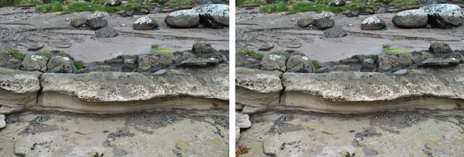
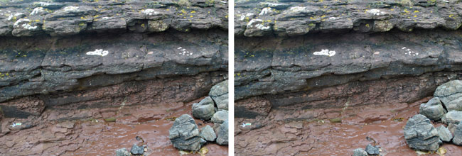
 Near Eddie's bench (replacement of Colonel Laird's bench), at NS 026 431, the last whitish sandstone is the
final Carboniferous (359-299 Ma) deposit, and the first, red, sandstone is the earliest wind-blown, sand dune
deposit from the Permian (251-299 Ma). 26 May 13.
Near Eddie's bench (replacement of Colonel Laird's bench), at NS 026 431, the last whitish sandstone is the
final Carboniferous (359-299 Ma) deposit, and the first, red, sandstone is the earliest wind-blown, sand dune
deposit from the Permian (251-299 Ma). 26 May 13.
Layered deposits containing seashells, et alia, may be found in the steep cliff above the workshop of
sculptorcarver Marvin Elliott. 8 July 15:-
 The pamphlet "Isle of Arran Trails Geology" (The Highlands and Islands Development Board) is a brilliant
concise account of the rock sequences.
The pamphlet "Isle of Arran Trails Geology" (The Highlands and Islands Development Board) is a brilliant
concise account of the rock sequences.
 A seal by Corrie Hotel carved by Marvin Elliott.
The rock upon which it is fixed is a glacial erratic, a granite boulder transported by ice.
A seal by Corrie Hotel carved by Marvin Elliott.
The rock upon which it is fixed is a glacial erratic, a granite boulder transported by ice.
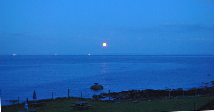
Marvin's seal seen by moonlight, 25 May 13, 2233 EDT
 Along the southeast coast of Arran at Kildonan may be found a dyke swarm, intrusions about 60 Ma ago
of hard Tertiary volcanic rock into softer sedimentary layers. The view is from NS 016 211 towards the
island of Pladda a mile away.
Along the southeast coast of Arran at Kildonan may be found a dyke swarm, intrusions about 60 Ma ago
of hard Tertiary volcanic rock into softer sedimentary layers. The view is from NS 016 211 towards the
island of Pladda a mile away.
Looking eastwards from NS 016 212
 Rocks of the sills have not eroded as much as the layers into which they have penetrated.
The view is from NS 016 211, looking at the west side of a dyke.
Rocks of the sills have not eroded as much as the layers into which they have penetrated.
The view is from NS 016 211, looking at the west side of a dyke.
Looking down at the top of a dyke, at NS 013 210
Cracks on the top of a dyke at NS 015 210
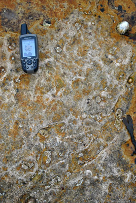
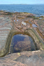
 Interesting marks at NS 0175 2111; and fossil ripples in Triassic sandstone of age ~220 Ma at Ns 0178 2110,
an indication of gentle, water-borne deposition.
Interesting marks at NS 0175 2111; and fossil ripples in Triassic sandstone of age ~220 Ma at Ns 0178 2110,
an indication of gentle, water-borne deposition.
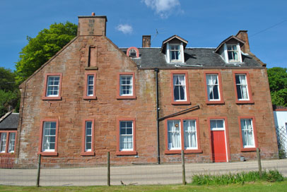
The houses at the west of Kildonan near the fossil ripples at NS 0178 2110
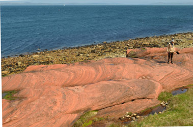
 From Blackwaterfoot at the southwest of Arran, King's Caves (at NR 884 309) are found after an easy walk up
the west coast. They were formed ~6000 years ago when sea level was higher. Relieved of the weight of ice, the
land has since undergone isostatic rebound. The local rock is Permian desert sandstone about 250 Ma old.
From Blackwaterfoot at the southwest of Arran, King's Caves (at NR 884 309) are found after an easy walk up
the west coast. They were formed ~6000 years ago when sea level was higher. Relieved of the weight of ice, the
land has since undergone isostatic rebound. The local rock is Permian desert sandstone about 250 Ma old.
Layering at different times with different orientations, forming angular unconformities
A good place, near King's Caves, to have lunch (22 May 13: Gerd Ragette, Atsumu and Andree Ohmura)
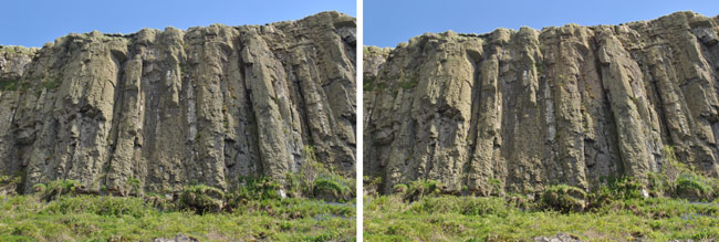
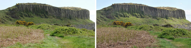 Granite columns of the Drumadoon sill on Arran. The stereo view is included for the
foreground. Right-eye view by Atsumu Ohmura. The photos were taken within ~1 minute of one another;
note the different illumination of the cliffs.
Granite columns of the Drumadoon sill on Arran. The stereo view is included for the
foreground. Right-eye view by Atsumu Ohmura. The photos were taken within ~1 minute of one another;
note the different illumination of the cliffs.
 Granite columns of the Drumadoon sill on Arran. Looking up at the cliffs from NR 885 293 at 1513, half an hour
later than the above. According to an account by
Farnham Geological Society, this
is a quartz feldspar porphyry intrusion of Tertiary age (60 Ma), into Triassic red marls and siltstones.
Granite columns of the Drumadoon sill on Arran. Looking up at the cliffs from NR 885 293 at 1513, half an hour
later than the above. According to an account by
Farnham Geological Society, this
is a quartz feldspar porphyry intrusion of Tertiary age (60 Ma), into Triassic red marls and siltstones.
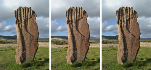 The Heritage Museum at Brodick on Arran provides a good account of the standing stones at Machrie.
This is Machrie Moor 3 at NR 910 324.
The Heritage Museum at Brodick on Arran provides a good account of the standing stones at Machrie.
This is Machrie Moor 3 at NR 910 324.
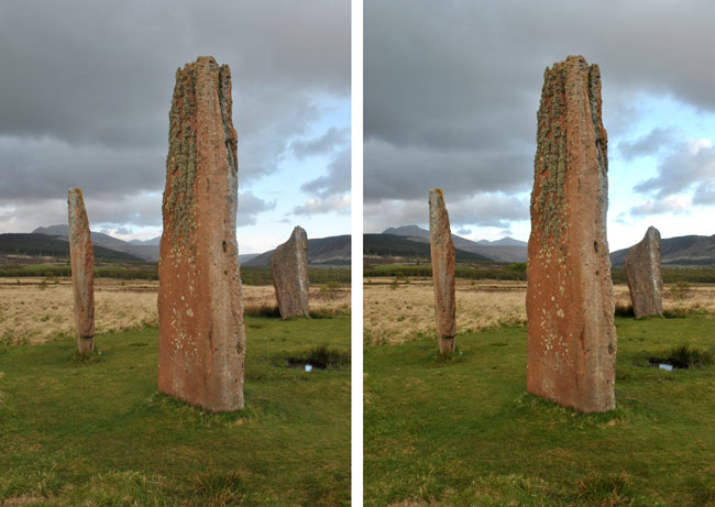
Machrie Moor 2.
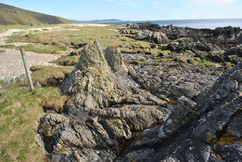
Rocks at Imachar Point, looking southwards at NR 864 402. 24 May 13.
Details of the above.
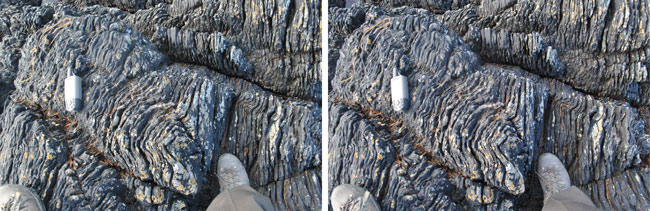
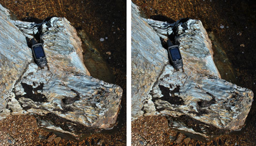
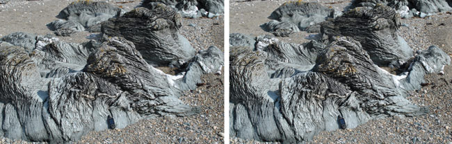
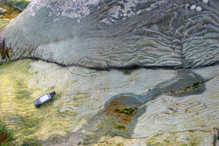
Dalradian schist at Imachar. Stereo viewing reveals the depths of the cracks between the layers.
My GPS is 15.6 cm long. 24 May 13.
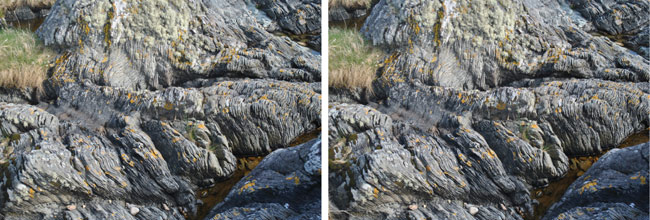
Dalradian schist at Imachar. 8 July 15..
Dalradian schist at Imachar. 8 July 15..
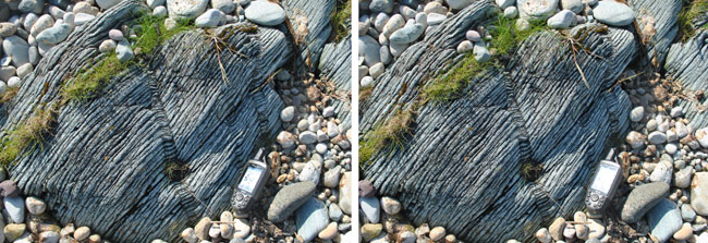
Dalradian schist at Imachar. 25 May 13.
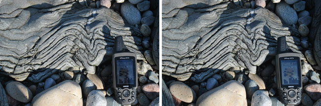
Dalradian schist at Imachar. My GPS reads NR 864 403. 8 July 15..
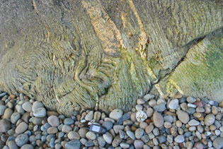
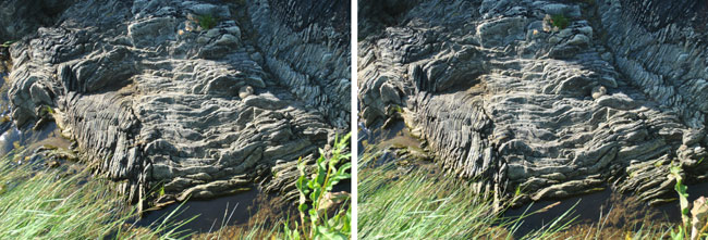
More of the distortions visible at Imachar. 25 May 13..
A smoothly eroded surface at Imachar. 8 July 15..
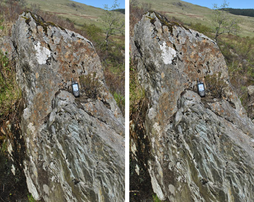
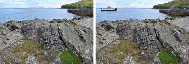 Arran's oldest rocks, at Lochranza (NR 926 510). Greenish Cambrian schists formed from sea muds and gravels
laid down some 600 Ma ago. The greenish colour is caused by the mineral chlorite and contrasts with veins of
pure white quartz. Included here is the ferry on which I left Lochranza on Arran for Claonaig on Kintyre and
points north on 26 May 13.
Arran's oldest rocks, at Lochranza (NR 926 510). Greenish Cambrian schists formed from sea muds and gravels
laid down some 600 Ma ago. The greenish colour is caused by the mineral chlorite and contrasts with veins of
pure white quartz. Included here is the ferry on which I left Lochranza on Arran for Claonaig on Kintyre and
points north on 26 May 13.