Frontispiece
About Nine Tries at Stereo-Pairs:- Heaven
© Charles Warner 11 October 2016
This site is for everyone interested in enjoying life to the full, by making full use of both eyes.
In "About Nine Tries at Stereo-Pairs:- Heaven" I explain that 9 independent
tries should be made on 9 consecutive days to see cross-eye. Each try should last from 2-3 minutes to no more
than about 8 minutes, to avoid becoming tired or
fed up. A stunning accomplishment is expected from a very small total investment: Just follow this simple
disciplined plan. Here is an Index of keywords:
Aareschlucht,
Africa,
Arran, air
pollution,
Archaeology (Guildford Castle),
Birang Gorge, University of
Birmingham,
Blyde River,
BUILDINGS,
Cappadocia,
China,
CLOUDS
Concorde,
CREATURES,
Jon Edgar,
Marvin Elliott,
entropy,
EXPLORE,
Donald Fisher,
Fujifilm 3DW1,
fulgurite,
God's Prayer,
Google Earth,
hassle,
Hindhead,
Hutton's Unconformity,
Jet (moo-cow),
Knockan Crag,
Janis Kraulis,
Machu Picchu,
Brian May,
McGill University,
Meiringen,
Met Office,
Middle East (ICAHD), Inner
Mongolian Adventure, monsoons,
music (Haslemere),
Naturetrek, Professor Atsumu
Ohmura,
Oxford University,
Panoramio,
Peru, [Politics,
Philosophy, Economics (PPE)],
Picasaweb,
PLANTS,
Radcliffe Observatory, Dr Rama
Ramalingam,
Rigi,
ROCKS,
Runkelstein,
sailing,
Scotland,
Scourie,
Seeing things,
Sherlock Holmes,
Siccar Pt,
Sichuan,
Stave churches,
Stepping Stones School,
stereo cards,
Stormy Weather Group,
Stratford Hall,
Swaziland,
tabloid,
Tephigram,
Tesco,
Thirlestane Court,
Tien Bao Shan,
turbulence,
Turkey,
Undershaw,
Viewing stereo pairs, University of
Virginia,
Wallensee, global
warming, research in
weather and climate sciences,
web design,
Witley,
Yellowstone,
Yunnan, Professor Isztar
Zawadzski
Technical case studies of winter monsoon clouds appear on the page
page2.html
[29 Dec 78 (height scales of water over tropical oceans)], and
the smaller page
page3.html
[17 Dec 78 (including narrow humilis)]; then follows a page named
bay.html about
"Convective sweepers of the Asian monsoons".
These pages contain original material; they are to let meteorologists gain familiarity by clicking rapidly
through many examples. Study that way is easy with presentation on the web in the manner developed here,
and very demanding otherwise. Variety is a necessary feature of tropical oceanic cloud formations:
Nature is chaotic in the purposeful pursuit of Life.
Reference is made occasionally to autobiographical sketches, Purple Patches; we have a statement
of intent designed to yield a simple Deed of Agreement; many of my personal data
have scientific value. Letters published in the Haslemere Herald newspaper on
Politics, Philosophy and Economics also have value. Of book chapter length, CARE
essays are envisioned, suitable for investigative journalism.
Solving our economics problems could be quite easy. (Please help show how to make good on
Free us up - on the costs of hassle and
inefficiency).
My formal curriculum vitae is at the end. Unhappily, some of the material may be offensive.
["A gentleman never gives offence unintentionally." (Chris James, Sunday Telegraph, 20 Nov 11)]
INTRODUCTION (The Color Purple; the Cyclops; Alice)
SEEING THINGS
VIEWING stereo-pairs, explained briefly as follows:-
Suppose that you are standing in the middle of a church, looking up from the floor at the structure of its spire.
In the left-eye view the middle part, the highest, will be slightly left of centre;
in the right-eye view it will be slightly right of centre.
Laid side by side, the left- and right-eye views will be as shown below.
Lower your head towards the middle of the diagram until it is close to your eyes.
Relax all your eye muscles (breathe out). Allow your eyes to see three blurred squares.
Forget the two outer ones on the edge of your field of view. Just look at the middle square.
Now slowly move your head away to a comfortable distance. The middle square will come into focus.
You will see up into the church spire, the inner circle far above, then the middle circle,
with the outer frame quite close above your head. The flat screen yields a wonderful impression of depth.
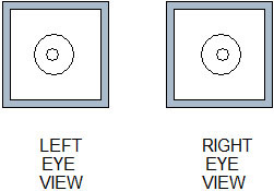
A shark catching fish
How many fish does the shark get? He gets just the middle fish. The other two fish are further away from the
snapping jaws.
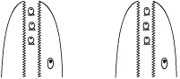
That is 'relaxed-eye' viewing. The largest picture size
cannot exceed the separation of the viewer's eyes, about 65 mm. 'Cross-eye'
viewing enables one to see big pictures. Stereo-pairs shown here are generally presented this way.
Look at the left picture with your right eye, and vice
versa. Crank in the muscles which point the eyes as though squinting at
something close up, but keep the focusing muscles more relaxed, as appropriate
for normal comfortable focusing. Concentrate on the middle image, and
allow it to come into focus. (The escaping fish are now seen to be nearer
to the viewer, rather than further away.) Once you have discovered the
conditioned reflex, cross-eye viewing is simply like flicking a switch from
normal to stereo settings. The brain locks on to the stereo.
(back)
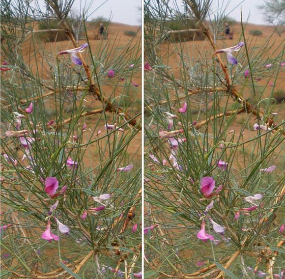
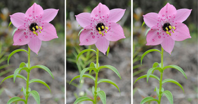
STEREOS OF PLANTS
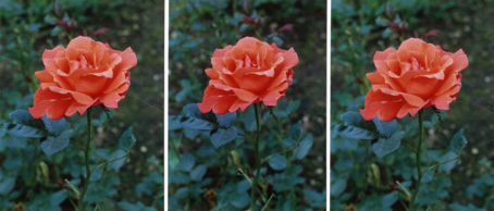 This Alexandra rose is a good subject for a stereo because its petals have intricate curves and they are arranged
in a compact group which stands out well from the background, chosen to be a uniform dark colour. They are easy
for the brain to latch on to.
Natural roses have only 5 petals. This is a hybrid. The pair on the left is for relaxed-eye viewing;
the pair on the right for cross-eye: The trio features two of the left-eye view with a right-eye view in the
middle (LRL).
This Alexandra rose is a good subject for a stereo because its petals have intricate curves and they are arranged
in a compact group which stands out well from the background, chosen to be a uniform dark colour. They are easy
for the brain to latch on to.
Natural roses have only 5 petals. This is a hybrid. The pair on the left is for relaxed-eye viewing;
the pair on the right for cross-eye: The trio features two of the left-eye view with a right-eye view in the
middle (LRL).
1. Block off right hand picture. 2. Lower your head to place each eye above picture.
3. Gradually lift head to a comfortable distance
1. Block off left hand picture. 2. Cross your eyes. 3. Relax
Relaxed-eye viewing demands presentation at small size. Accepting this limitation,
members of the Stereoscopic Society produce very fine
relaxed-eye stereos. Where large size is deemed highly desirable, only cross-eye stereos are presented.
The seeing of cross-eye stereos is not generally difficult.
It does take time to learn the conditioned reflex.

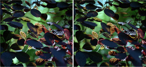
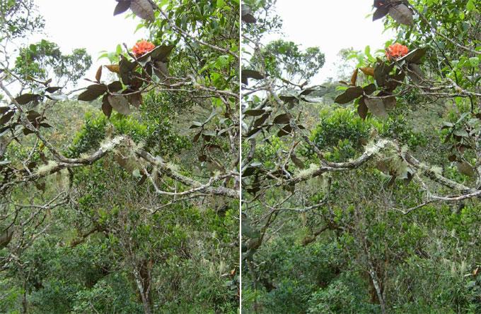
Cotinus coggygria, purple smokebush, in Grayswood, England (July)
This stereo is difficult to acquire, so red fiducial marks are placed above the two views.
Squint so as to make just three instead of two red marks: relax focusing to acquire the stereo.
Leaves back lit by the afternoon sun contrast with others in shadow - like dull round medallions.
Question 1: Given that the leaves are about 3 cm across, how thick is the bush? (Answer 1)
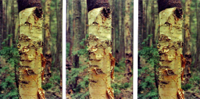
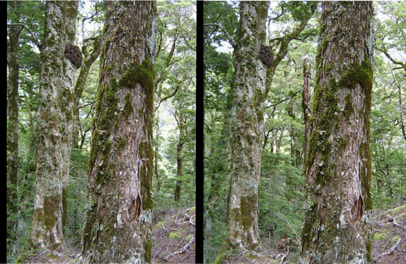
Birch bark in the Adirondack mountains of upper New York State, USA (May)
The bark of the tree shows up nicely. The central vertical is relatively easy to hold and bring into focus.
The peelings of paper thin bark stand out clearly. It seems that one could touch them.
Why is the bark black at the top of the picture? How often do we look through botanical books for identification
of a plant, and find that the evidence is not quite good enough to be sure?
Single pictures of tree bark often do not help much.

Mountain Laurel (Kalmia latifolia) on Trayfoot Mountain, Shenandoah National Park, Virginia, USA (May)
Pink buds with ten-fold symmetry open into goblet-shaped white flowers.
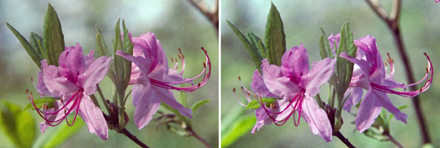
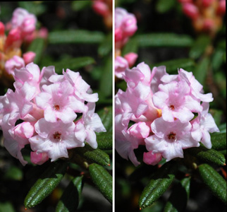
Pink azalea (Rhododendron periclymenoides) in Shenandoah National Park (May)
These are rather ethereal little flowers compared with the big robust shrub shown below.
(back)
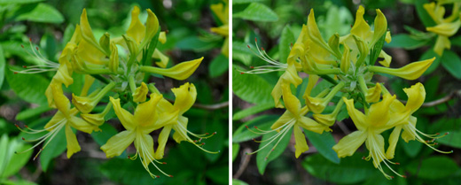
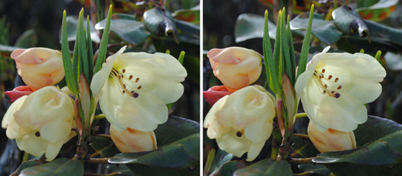
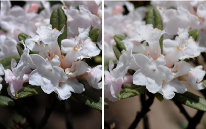
Rhododendron luteum at the Devil's Punch Bowl, Hindhead, UK (May)
In May this loveable deciduous yellow azalea fills the air with its scent.
I thank David Millais, (www.rhododendrons.co.uk),
from whom you can buy your own R. luteum, for help with identifications.
Question 2: How many pollen-bearing stamens have these two azaleas? (Answer 2)
An epiphytic Rhododendron (?) - up a tree, seen from the trail up Mount Kinabalu, Borneo (April)
There is a lot going on in this scene, at a variety of ranges from the viewer.
This is a difficult stereo. So was the trail up the mountain.
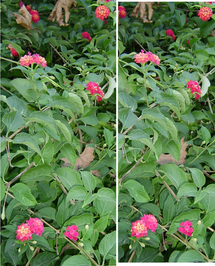 Wildflowers at Olympos on the Mediterranean coast of Turkey (December). Probably Lantana camara.
It is difficult to try to discriminate between possible alternatives to be found in an ordinary one-eye wildflower guide.
Oh that we had lots of stereo wildflower guide books!
It seems desirable to retain the flowers at top right and top left.
These are at a different range from the others. What has caused the different red colours?
This is not the easiest of stereos; and Turkish is not the easiest of languages.
Wildflowers at Olympos on the Mediterranean coast of Turkey (December). Probably Lantana camara.
It is difficult to try to discriminate between possible alternatives to be found in an ordinary one-eye wildflower guide.
Oh that we had lots of stereo wildflower guide books!
It seems desirable to retain the flowers at top right and top left.
These are at a different range from the others. What has caused the different red colours?
This is not the easiest of stereos; and Turkish is not the easiest of languages.
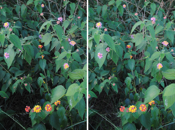
Similar flowers seen at Mlilwane Wildlife Sanctuary, Swaziland (February 2011)
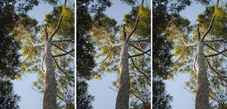
Eucalyptus soaring upwards 50 m at Mlilwane Wildlife Sanctuary
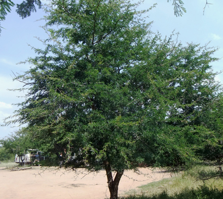
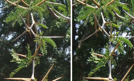
Acacia at Hluhluwe Game Reserve, South Africa, much eaten by elephants (back)
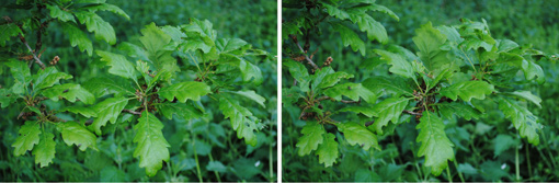
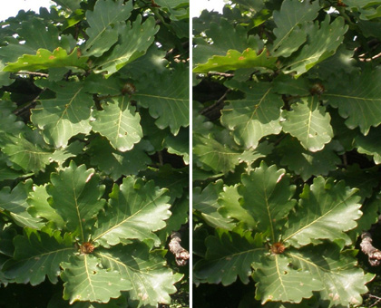
Leaves of sessile oak (Quercus petraea) at Emley Farm, Surrey, UK (May)
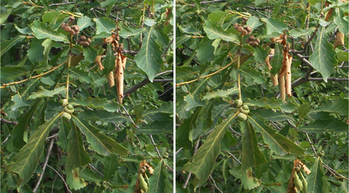
Oak photographed from the Great Wall of China at Mutianyu (August)
About 1 km along the Wall north of the top of the chair lift at Mutianyu, at altitude near 620 m,
these leaves and acorns are probably of Quercus mongolica (compare
www.efloras.org) -
or perhaps a hybrid involving Q. dentata or aliena .
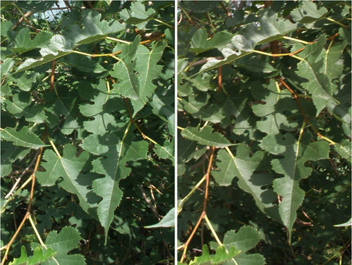
Oak photographed from the Great Wall of China at Mutianyu (August)
At altitude near 500 m, these leaves may be of Quercus dentata
(www.efloras.org).
I thank Drs Jinshuang Ma and Quanru Liu,
authors of Flora of Beijing (2003),
and Mark Flanagan and Tony Kirkham, authors of Wilson's China a Century On, Kew Publishing, 2009,
for help with tentative identifications.
Mulberry photographed from the Great Wall of China at Mutianyu (August)
These leaves are acuminate, lobulate and serrated in a distinctive way.
Examples of Morus alba resemble them (see the photo on p 52 of Plantsman's Paradise Travels in China
by Roy Lancaster, Garden Art Press, 2008; also
www.efloras.org).
The left-eye view is slightly out of focus - but the brain helps itself to the best of the information from both pictures.
Stereo photography, easy, is to facilitate difficult botanical identifications. (back)
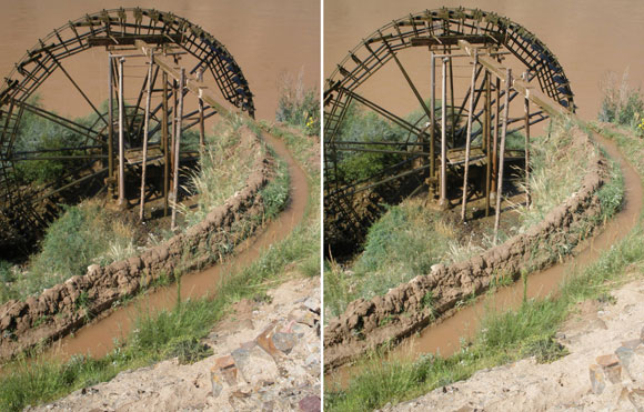
Waterwheel on the Yellow River, Ningxia, China.
For irrigation for villages upstream near Beichangtan, this wheel is fitted with cylinders
which slope upwards at the bottom and fill from the river,
and downwards at the top to empty into the irrigation channel.
Compare this with the view by Trevor Patton.
This moving wheel would have been a suitable subject for the
Fujifilm 3DW1
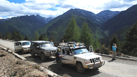
stereo camera. These pictures were taken on an EXPLORE tour in 2009 called Inner Mongolian Adventure
(see also purple10.html)
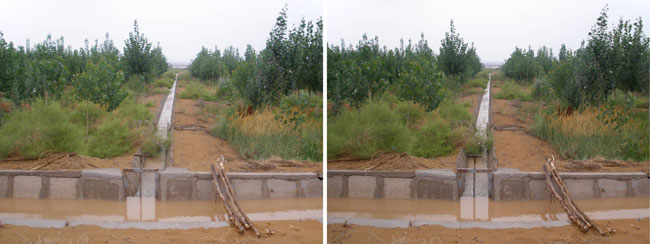
From the Yellow River, irrigation of the Tengger Desert near Zhongwei.
Note in stereo that the level of the main supply of water (see the foreground)
is substantially above that of the local channel,
which in turn is above the level at which the mixed vegetation has been planted.
The sweetvetch Hedysarum scoparium Fischer et Meyer (August).
Popular with camels on the fringes of the Tengger Desert near Zhongwei,
this shrub was kindly identified for me by Dr Li Xinrong of the Shapotou Desert Experimental Research Station.
It retards blowing desert sand. Its spidery character,
with different textures of the wood and of the reed-like flower stems, comes out well in stereo.
(Another EXPLORE tour member was standing about 20 m away.)
Question 3: How are the leaves of this plant arranged? (Answer 3) (back)
Botany with Naturetrek in southwest China has yielded
many intriguing stereo-pair photographs
for botanical interest - plus innumerable difficult problems of identification.
The diversity of plants among the peaks and gorges of the Himalayas follows from
diversity of evolution concentrated in this small exciting area,
notable for having kept apart the peoples of India and of China. For this tour I bought a Nikon D3000
digital Single Lens Reflex camera. (back)
White clematis montans seen among rhododendrons and trees from a chairlift. See
Yunnan, China, for a tour report and
picasaweb for more photos. (4 June 10).
Pedicularis possibly densispica at Wenhai near Lijiang,
Yunnan, China (5 June 10).
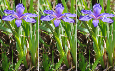
Iris probably bulleyana south of Zhongdian (renamed Shangri La), Yunnan (8 June 10)
Rhododendron probably wardii (8 June 10)
South of Zhongdian, Yunnan. The flowers are quite small, bulbous and moist
compared with rhododendrons commonly found in England.
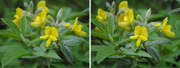
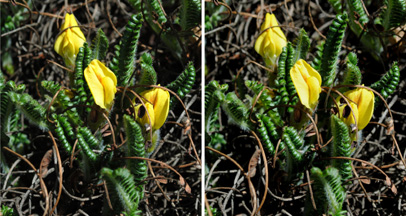
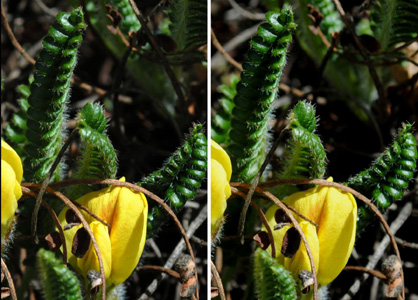
Piptanthus probably concolor (9 June 10)
South of Zhongdian, Yunnan. The shape is not symmetrical.
The family is Fabaceae (Pea), to which laburnum also belongs.
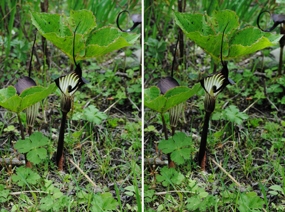
The cobra lily Arisaema elephas near Tien Bao Shan near Zhongdian, Yunnan (9 June 10)
It has widely spread organized structures. The flower is in front, and the large leaf is on a separate stalk.
Here there are two of these plants, facing in different directions.
Compare the mountains in this vicinity with the Peruvian Andes.
Question 4: Which part of the plant is the spadix and which is the spathe? (Answer 4)

Rhododendron possibly rupicola (10 June 10)
On the road eastwards descending towards Langdu (2700 m), Yunnan.
I thank Mark Flanagan for the tentative identification.
Rhododendron possibly trichostomum (11 June 10)
On the road west of Riwa, Sichuan, China,
at the location shown below. The upper two pictures were taken at 1746,7 local time
and are probably from the same plant; the third was taken of a different plant at 1749.
The leathery leaves are elliptical and measure roughly 5 x 1 cm, with apex acute with
a small red ending. I thank Mark Flanagan and David Millais for the tentative identification. Leaves according to
www.efloras.org
would then be too small; the plants may be hybrids.
Probably Spongiocarpella (= Chesneya) nubigena (11 June 10)
On the road west of Riwa at 1748 local time, another member of Pea family Fabaceae.
In Sichuan as opposed to Yunnan, this plant was too far east according to
www.efloras.org).
The lower stereo view - magnified - shows that the leaves were markedly incurved (after drying).
Question 5: What other plant(s) show such incurved leaves, and why do they do this? (Answer 5)
Naturetrek tour group stopped for plants, S W Sichuan (11 June 10)
Approaching the pass at 4100 m over Er Chu Shan. This photo is on Google Earth at
28.5375°N, 100.1924°E, 3880 m, looking SW at 1750 local time,
within 4 min of the time of the above Rhododendron and Chesneya pictures.
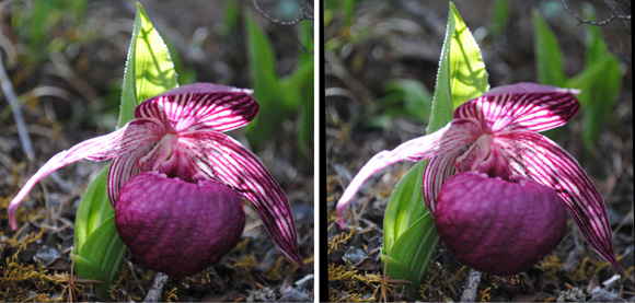
The slipper orchid Cypripedium tibeticum (12 June 10)
Near Zhuoma La Lake in Yading Nature Reserve, Sichuan. We found Cypripedium tibeticum at 4000 m altitude,
a little higher than expected. In stereo this looks like a bird in flight.
Question 6: This orchid has a very unusual structure - as unusual as the cobra lily Arisaema elephas
shown above. Why should such singular plants exist? (Answer 6)
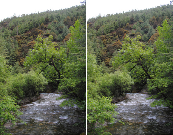
Mixed forest of Birang Gorge (16 June 10)
Northern Yunnan, China. Looking downstream. These views would have been suitable for the
Fujifilm 3DW1
stereo camera with its two camera lenses separated by 77 mm.
I took left and right-eye views at about this separation with an ordinary camera, so the water is fuzzy.
[see also rocks].
Question 7: In each of these two views, how far does the river flow before vanishing from sight?
(Answer 7)
Nomocharis probably forestii near Zhongdian,
Yunnan (16 June 10)
This little flower extends out to you its yellow pollen-bearing anthers
The poppy Meconopsis probably racemosa near Zhongdian, Yunnan (16 June 10)
I distinguish this from the very similar M. prattii
on the basis of the "dense, spreading bristles" seen on the ovaries at the bottom of the picture
(www.efloras.org).
The petals appear to be made of tissue paper.
Corydalis (17 June 10)
On Shika Snow Mountain near Zhongdian. This is an unusual plant. Stereo viewing reveals the pod-like shapes.
Fumewort is the English family name. The Greek
korydalis means “crested lark”.
Beech (Nothofagus) forest (January)
In Mount Aspiring National Park on the South Island of New Zealand at latitude 44°S.
Moss grows on the flaky tree bark, in a manner reminiscent of tropical rain forest.
Question 8: What is the black excrescence growing on the tree which is half hidden at left? (Answer 8)
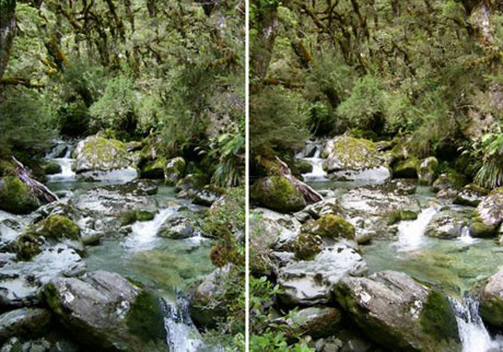
Forest scene on the first day of hiking the Routeburn Track on the South Island of New Zealand (January)
The turquoise blue colour of the stream follows from the friction of glacial ice on rock and is due to
Rock flour
Left- and right-eye views were not taken simultaneously and the waterfall is fuzzy
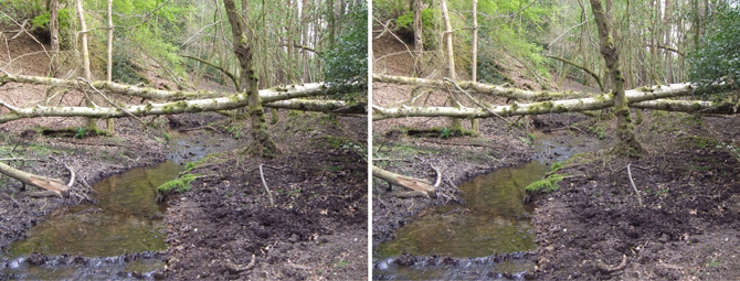
Stream by Keeper's Cottage in the Devil's Punch Bowl, Hindhead (May)
Suitable for the 77 mm baseline built into the camera, this stereo was taken with the
Fujifilm 3DW1 stereo camera. I used a tripod and maximum resolution.
The mud and bits of tree and the little waterfall in the foreground are faithfully recorded,
as well as the distant green leaves.
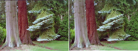 A descending branch of Noble Fir (Abies procera) with the bole of the tree on the left. Behind it,
redder in colour, is the bole of a Giant Sequoia (Sequoiadendron giganteum). Hindhead, Surrey (July 97)
A descending branch of Noble Fir (Abies procera) with the bole of the tree on the left. Behind it,
redder in colour, is the bole of a Giant Sequoia (Sequoiadendron giganteum). Hindhead, Surrey (July 97)
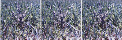 This thistle, on Stave Island in the St Lawrence River, Ontario, home of my
McGill professor friend Eberhart Vowinckel,is relatively difficult for the
brain to acquire because it is hidden in the grass.
This thistle, on Stave Island in the St Lawrence River, Ontario, home of my
McGill professor friend Eberhart Vowinckel,is relatively difficult for the
brain to acquire because it is hidden in the grass.
Question 9: How many leaves has it?
(Answer 9) (back)
STEREOS OF CREATURES
I used to have a simple stereo beam splitter which fitted on to the front of the 55 mm lens of my camera.
It divided the frame into two halves, corresponding to two eyes 70 mm apart. The
Fujifilm 3DW1 stereo camera
has quite a large baseline - 77 mm - suitable for relatively large animals, waterfalls and rivers.
The 1997 portraits were taken with the beam splitter:
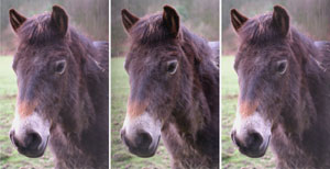
An Exmoor pony in the Devil's Punch Bowl, Surrey (March 1997)
Kept by the National Trust in a field down by Keeper's Cottage, this pony and his mates were having lunch. Full
of food, he kept still enough for me to get the stereo. His fur is rather rough and bits of hay are on his mane.
The ponies are supposed to keep suppressed vegetation other then the heather considered desirable for Surrey
heathland.
Question 10: YISDER ASMENI, OSISASIS ASDERISOS, (Answer 10)
 Sadie and Tobias, chihuahuas, in the arms of Sam King, well cared for at Treetops Boarding Kennels
(Guildford) for Patricia Talbot-Carey (Dec 2013)
Sadie and Tobias, chihuahuas, in the arms of Sam King, well cared for at Treetops Boarding Kennels
(Guildford) for Patricia Talbot-Carey (Dec 2013)

Caragh and Sinead Hunter on a child's swing (March 1997)
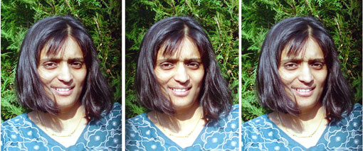
Mrs Priti Patel glowing with the good health of her pregnancy (March 1997)
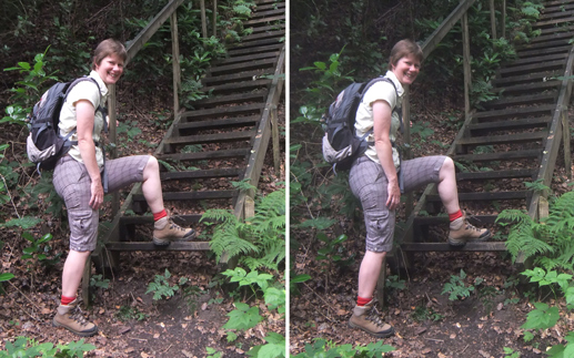
Miss Heather Dillon (Ramblers' Association) (July 2011)
Heather was showing that the bottom step was too high:
insufficiently good work by the RA Work Party who erected these new steps.
They ascend to Grayswood Hill where Geoffrey Pilkington lived in the 1960's.
The 77 mm baseline of the Fujifilm 3DW1 camera is good for the steps and the hill,
but I would have preferred to guess by eye a baseline of some 45 mm to try to capture Heather.
Question 11: What is the size of the unacceptably large drop off the bottom step?
(Answer 11)

My neighbour Chris Sanguinetti and our Rottweiler CJ
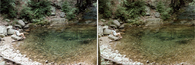
Sandy sitting by the swimming hole in Rip Rap Hollow, Shenandoah National Park, Virginia, USA (August 1983)
Stereo viewing indicates the depth of the hole and how the hiking trail leads straight into it.
Zoe, student of Geology at Edinburgh University, at Siccar Point on 4 Sep 12.
The weather was a bit windy but this didn't seem to matter.
The Indonesian family of my new friend Brian atop Arthur's Seat, Edinburgh. 14 July 15.
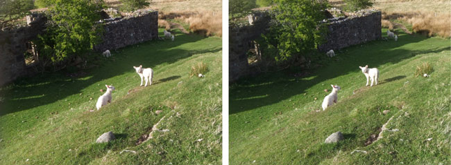
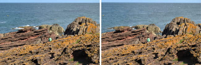
Lambs near the standing stones at Machrie on Arran, Scotland.
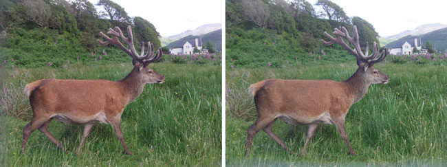 A (red?) deer at Lochranza on Arran, Scotland.. These pictures were underexposed in Photoshop in order to
retain the mountain in the background. 8 July 15. (back to Arran).
A (red?) deer at Lochranza on Arran, Scotland.. These pictures were underexposed in Photoshop in order to
retain the mountain in the background. 8 July 15. (back to Arran).
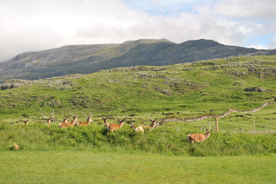
Red deer by Inchnadamph Lodge, Scotland, paradise for geologists et alia. 11 July 15
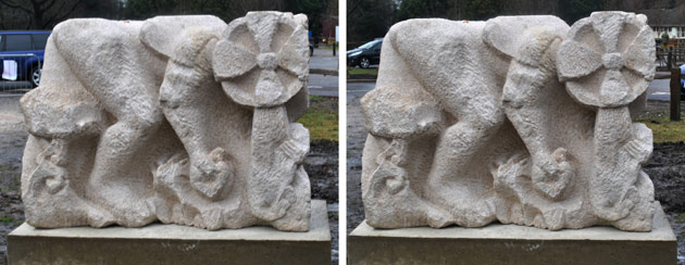
Jon Edgar's Portland Stone at Hindhead:
The artistic A3D project for schools is to stimulate interest
in heritage and the arts ...
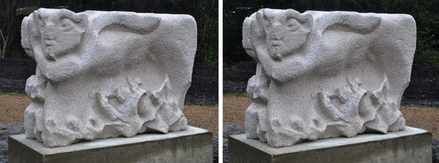 ... on 18 March 2013 a cloudy sky yielded nice uniform illumination by diffuse sunlight. See
more photos which celebrate this project
and the closing of the old A3 road through Hindhead
... on 18 March 2013 a cloudy sky yielded nice uniform illumination by diffuse sunlight. See
more photos which celebrate this project
and the closing of the old A3 road through Hindhead
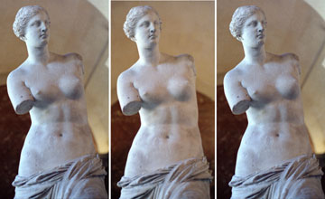 Venus de Milo at the Louvre in Paris. The statue was found in 1820 by a peasant on the Greek island of Melos, or Milo,
in the Mediterranean halfway between Athens and Crete. It was sold to the French government for £240.
The fine details are well captured in stereo. The skin appears wonderfully smooth.
Venus de Milo at the Louvre in Paris. The statue was found in 1820 by a peasant on the Greek island of Melos, or Milo,
in the Mediterranean halfway between Athens and Crete. It was sold to the French government for £240.
The fine details are well captured in stereo. The skin appears wonderfully smooth.
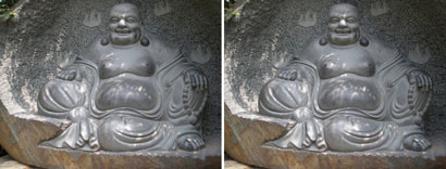
Laughing Buddha in the
grounds near the Big Wild Goose Pagoda, Xi'an, China
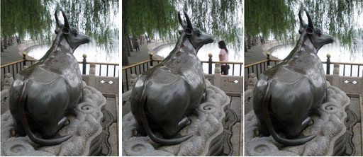
Bronze Ox at the Summer Palace, Beijing. In 1755, Emperor Qianlong ordered it cast so as to control floods
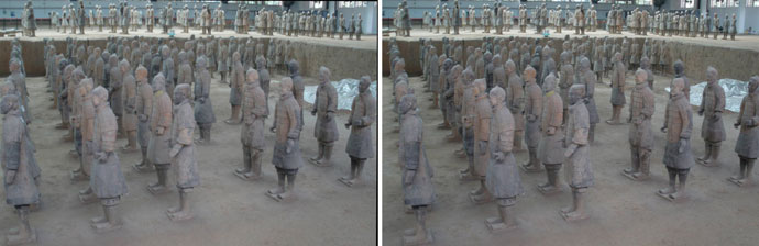
Terracotta warriors for Emperor Qin Shi Huang (d 210 BCE), situated 40 km east of Xi'an
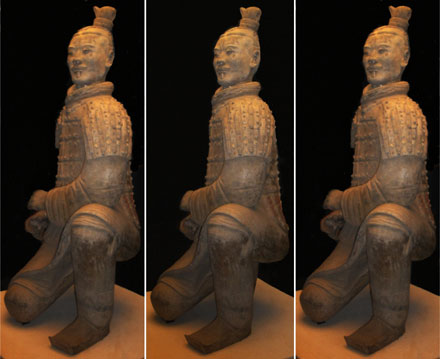 Kneeling archer of the terracotta warriors. Excellent photos are provided in the small book by Jane Portal
"The Terracotta Warriors" (British Museum Press, 2007),
but they are not stereo-pairs.
Kneeling archer of the terracotta warriors. Excellent photos are provided in the small book by Jane Portal
"The Terracotta Warriors" (British Museum Press, 2007),
but they are not stereo-pairs.
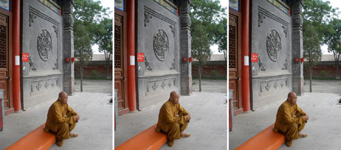
Monk at the North Pagoda, Yinchuan, China
If one does not have a stereo camera, portraits are better if the subject doesn't mind being still.
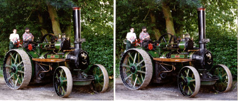 Jo Ann is a 1912 Aveling Porter agricultural engine belonging to Mrs Janet Rowland,
kept as part of a magnificent collection of steam engines at
Hollycombe Steam and Woodland Garden Society [June 1997].
Jason Hooker on the left was receiving driving instructions from David Dawtry;
they kindly agreed to remain stationary for long enough for me to take the two views,
separated by three steps sideways. (back)
Jo Ann is a 1912 Aveling Porter agricultural engine belonging to Mrs Janet Rowland,
kept as part of a magnificent collection of steam engines at
Hollycombe Steam and Woodland Garden Society [June 1997].
Jason Hooker on the left was receiving driving instructions from David Dawtry;
they kindly agreed to remain stationary for long enough for me to take the two views,
separated by three steps sideways. (back)
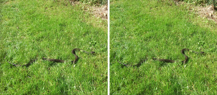
A snake in a grassy play area at Thirlestane Court, Hindhead, Surrey, UK
1 October 2011 was a very hot day, and this snake was spotted by young Scarlet O'Brien and her friend; it
spent a while out in the midday sun. I got this stereo with my Fujifilm 3DW1 stereo camera
as the snake escaped under a hedge, the head pointing forwards and moving rhythmically from side to side
as it progressed. The grass wasn't short enough for croquet.
Questions 12: What sort of a snake and how long was it? Why did the viper viper nose? (Answers 12)
Michael Garstang has written about the elephants and other animals of KwaZulu Natal
in his children's book "Ntombazana" (ISBN 978-0-615-18904-8), the fictional biography of a female elephant.
She grew up to become a matriarch at the time of coming of white men to South Africa. Poaching of wildlife eventually
led to the establishment of the Kruger National Park.
I went on safari with EXPLORE to try out the Fujifilm 3DW1 stereo camera on large animals.
More photos of South Afica and Swaziland seen on our tour are provided on Picasaweb, by me under
southern Africa, and by
Trevor Ashenden.
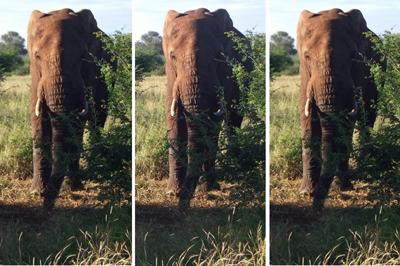 In February 2011 the Kruger National Park contained 1000 more elephants than considered healthy.
This one came close enough to our vehicle for use of the stereo camera.
For me this holiday was quite traumatic (purple12.html).
In February 2011 the Kruger National Park contained 1000 more elephants than considered healthy.
This one came close enough to our vehicle for use of the stereo camera.
For me this holiday was quite traumatic (purple12.html).
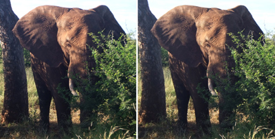 He may have extended his ears so as to listen; at 0645 am it was not yet hot enough to require cooling. See
Michael Garstang (2012): "Elephant Sense and Sensibility".
He may have extended his ears so as to listen; at 0645 am it was not yet hot enough to require cooling. See
Michael Garstang (2012): "Elephant Sense and Sensibility".
Question 13: How do we know he was a male? (Answer 13)
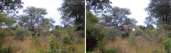
Another elephant browsing in Kruger National Park
The right eye view was taken 2 seconds after the left
with my Nikon camera while our vehicle drifted slowly along a baseline of ~2 m.

Lionesses taking it easy in Kruger National Park (taken by Fujifilm 3DW1)
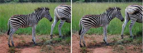
A fragile zebra foal in Mlilwane Wildlife Sanctuary, Swaziland (taken by Nikon). Here lions are excluded.
A hippo with another creature on its back, keeping cool in Kruger National Park
(taken by Fujifilm 3DW1)
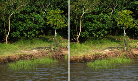
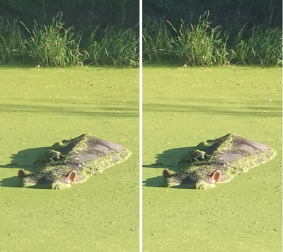
A crocodile in iSimangaliso Wetland Park, St Lucia, South Africa (taken by Nikon) (back)
STEREOS OF BUILDINGS
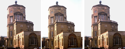
The Radcliffe Observatory, Oxford
The solid quality of the building, in local stone typical of Oxford, is pleasingly conveyed in stereo.
The Observatory is modeled on the Tower of the Winds, Athens, and was built around 1783.
The balustrade comes out clearly, and one can see through the east window to the west window on the other side.
Around the top of the octagonal tower are figures representing the winds.
Question 14: What was the purpose of the one-storey extension towards the viewpoint?
(Answer 14)
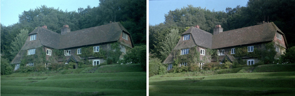
Old Manor Cottage, Grayswood, Surrey, late summer 1985
Charles and Olivia Warner were born in the middle bedroom on the East wing in 1938 and 1940.
The house appeared on the site originally in the 18th century as just a little cottage - linked to
a cottage next door. My early life is described in purple1.html.
(back)
Thirlestane Court was built in 1896 for the watercolour artist W. Biscombe Gardner.
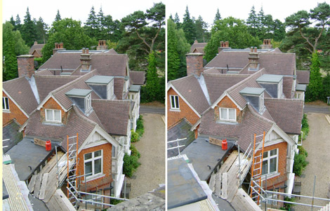 August 2003. The roof of the S wing of Thirlestane Court was rebuilt in 1997.
Fine details may be seen, both close by and among the distant trees.
August 2003. The roof of the S wing of Thirlestane Court was rebuilt in 1997.
Fine details may be seen, both close by and among the distant trees.
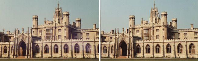 New Court, St John's College, Cambridge, built in 1831 across the Cam
from the rest of the College. John Lewis and I occupied one of the rooms at top right through the cold winter
of 1962-3.
New Court, St John's College, Cambridge, built in 1831 across the Cam
from the rest of the College. John Lewis and I occupied one of the rooms at top right through the cold winter
of 1962-3.
Brinscall, Lancashire, UK, home of Phillip Holmes my
engineer (geologist) friend who knows Knockan Crag. 2 July 15.
The church of St Paul, Withnell, Lancashire PR6 8SL, built 1851. 2 July 15
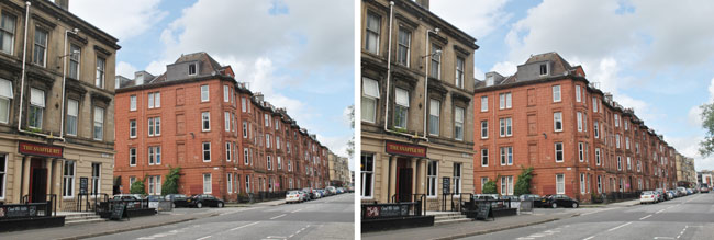
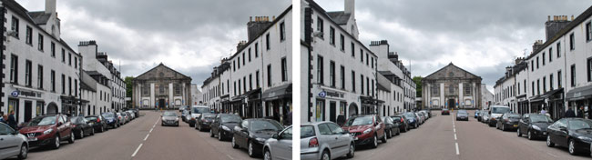
"The Snaffle Bit" pub in Sauchiehall St., Glasgow.
Further down (westwards) along Sauchiehall St., 5 July 15.
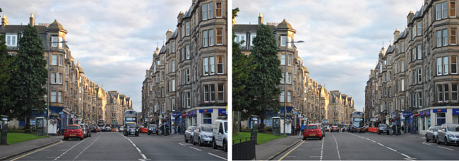
Question 15: What is the purpose of this large building on Warrender Park Terrace, Edinburgh (near my hotel,
the Bruntsfield Best Western)? (Answer 15)
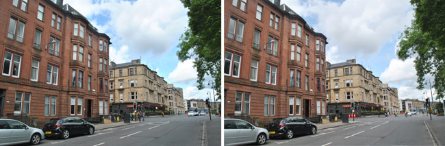
Looking down Bruntsfield Terrace, Edinburgh, with Leamington Terrace off to the right (NW). 15 July 15. For
me the building boom of the late 19th century marks a Victorian acceleration of human activity which is noteworthy in
discussions of the definition of an Anthropocene Epoch in the geological record.
 Inverary, Scotland (at grid reference NM 095 085). Founded in 1745 by the 3rd Duke of Argyll,
a set piece of Scottish Georgian architecture. 26 May 13.
Inverary, Scotland (at grid reference NM 095 085). Founded in 1745 by the 3rd Duke of Argyll,
a set piece of Scottish Georgian architecture. 26 May 13.
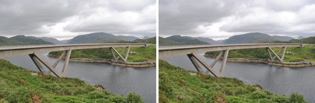 The magnificent concrete box girder Kylesku Bridge,
Sutherland, was opened in 1984. It crosses the Loch a' Chàirn Bhàin. 13 July 15.
The magnificent concrete box girder Kylesku Bridge,
Sutherland, was opened in 1984. It crosses the Loch a' Chàirn Bhàin. 13 July 15.
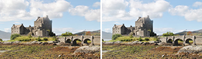
Eilean Donan Castle, Scotland, dating from the 13th Century, rebuilt in 1912-32.
Note that the Castle was built around a rocky core.
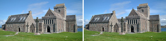 Iona Abbey, Scotland. Just west of Mull, the island of Iona has been inhabited for over 6000 years. St Columba
founded his monastery on this site in 563. Note the Celtic crosses - links with Ireland close to the southwest.
Iona Abbey, Scotland. Just west of Mull, the island of Iona has been inhabited for over 6000 years. St Columba
founded his monastery on this site in 563. Note the Celtic crosses - links with Ireland close to the southwest.
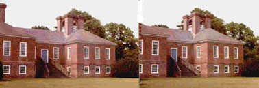 Squares feature in the structure of Stratford Hall, the family home of the Confederate general Robert E. Lee.
This plantation is in the northern neck of Virginia between the Potomac and Rappahannock Rivers. It was completed
about 1730. The four-fold chimney with arches and balustrades is remarkable, also the big staircase leading
up to the door.
Squares feature in the structure of Stratford Hall, the family home of the Confederate general Robert E. Lee.
This plantation is in the northern neck of Virginia between the Potomac and Rappahannock Rivers. It was completed
about 1730. The four-fold chimney with arches and balustrades is remarkable, also the big staircase leading
up to the door.
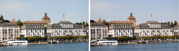
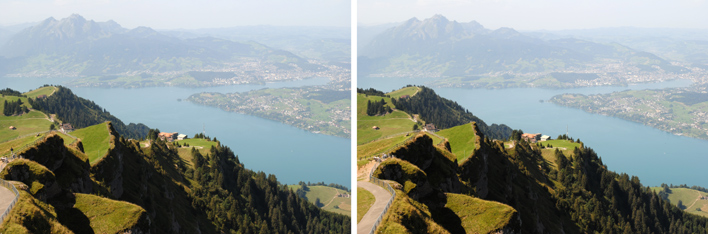
Lucerne, Switzerland, 23 Aug 11
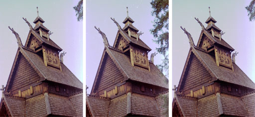
Originally built in ~1200, Gol stave church was rebuilt in 1886 at the Norwegian
Folk Museum at Bygdøy, 4 km west of Oslo and 130 km
southeast of its original site in Hallingdal. A driving holiday to Norway is described in
purple5.html.
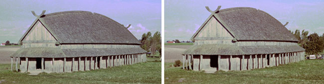 A barn seen on Sjælland, Denmark. Rather reminiscent of a boat - suitable for seafaring people. 23 Sep 72.
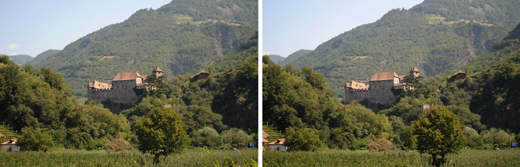
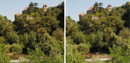
Castle Runkelstein high in the hills above Bolzano, Italy, 26 Aug 11
This beautiful castle dates from 1237 and contains frescos from the 14th and 15th centuries.
(back)
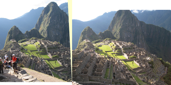
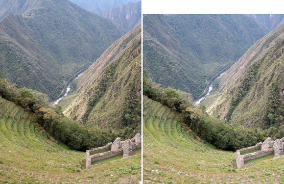
 Machu Picchu, Peru, "was built as a royal hacienda for Inca Yupanqui- Pachacuti- during his reign (1438-1471)"
according to a notice in the Museo Inka in Cuzco. Here is the first sight of it (by Lee Chandler) on approach
along the Inca Trail,
shortly after passing through the Sun gate Intipunku. This retreat was perched on its ridge - a very private place.
On the far side of the central green area is the tower of the Intihuatana or "Hitching Post of the Sun". Our
EXPLORE tour is described in purple9.htm.
Machu Picchu, Peru, "was built as a royal hacienda for Inca Yupanqui- Pachacuti- during his reign (1438-1471)"
according to a notice in the Museo Inka in Cuzco. Here is the first sight of it (by Lee Chandler) on approach
along the Inca Trail,
shortly after passing through the Sun gate Intipunku. This retreat was perched on its ridge - a very private place.
On the far side of the central green area is the tower of the Intihuatana or "Hitching Post of the Sun". Our
EXPLORE tour is described in purple9.htm.
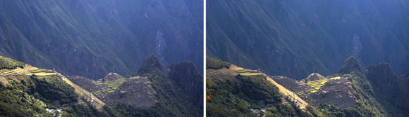
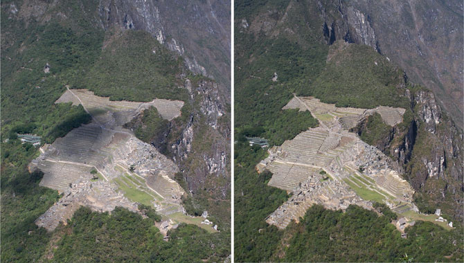 Machu Picchu, at altitude around 2430 m, seen from near the top of Huayna Picchu (2640 m).
[A small cloud was passing at the time of the right-eye view.]
The ground falls away sheer to the right (west) and more gradually to the east (left).
The modern bus station is at left, below the incoming Inca Trail.
Note in stereo the tower of the Intihuatana at front right.
(Compare Google Earth, which allows simulated flight over the surface by holding down move controls.)
Machu Picchu, at altitude around 2430 m, seen from near the top of Huayna Picchu (2640 m).
[A small cloud was passing at the time of the right-eye view.]
The ground falls away sheer to the right (west) and more gradually to the east (left).
The modern bus station is at left, below the incoming Inca Trail.
Note in stereo the tower of the Intihuatana at front right.
(Compare Google Earth, which allows simulated flight over the surface by holding down move controls.)
Question 16: Roughly how wide is the narrow saddle upon which Machu Picchu was built?
(Answer 16)
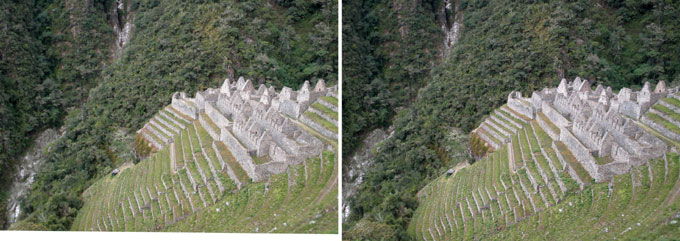
 Machu Picchu, seen on the approach along the Inca Trail (by Joy Jonstone). To the north, Huayna Picchu is
in the background; the trail up it may be discerned on its west side, on the left. Taken first, the right-eye
view was rotated slightly and trimmed; taken 10 min later at the point on the Inca Trail where the trees below
it end, the left-eye view was reduced before mounting. The brain compensates for distortions,
and allows inclusion of parts of the pictures not covered in stereo. (back)
Machu Picchu, seen on the approach along the Inca Trail (by Joy Jonstone). To the north, Huayna Picchu is
in the background; the trail up it may be discerned on its west side, on the left. Taken first, the right-eye
view was rotated slightly and trimmed; taken 10 min later at the point on the Inca Trail where the trees below
it end, the left-eye view was reduced before mounting. The brain compensates for distortions,
and allows inclusion of parts of the pictures not covered in stereo. (back)
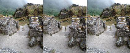
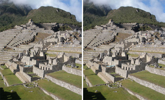 The southern part of Machu Picchu looking north. The Hut of the Caretaker of the Funerary Rock is perched high
up in the background. Many of the buildings in the foreground of this view appear in the foreground of the
previous view, but are seen from the opposite direction.
The southern part of Machu Picchu looking north. The Hut of the Caretaker of the Funerary Rock is perched high
up in the background. Many of the buildings in the foreground of this view appear in the foreground of the
previous view, but are seen from the opposite direction.
Lower buildings of Winay Wayna ("Forever Young", around 2620 m), close to Machu Picchu
Buildings and terraces of Winay Wayna; the Rio Urubamba below (looking to ENE).
Question 17: How high is Winay Wayna above the Rio Urubamba? (Answer 17)
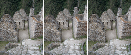
Details of buildings of Winay Wayna. Note the trapezoidal doorway and the little stone pegs
 Curved walls of Phuyu Pata Marca ("Cloud-level Town", around 3600 m). Of the late Inca style,
the site is treated in "The Inca Trail" by Richard Danbury (and Alexander Stewart)
Curved walls of Phuyu Pata Marca ("Cloud-level Town", around 3600 m). Of the late Inca style,
the site is treated in "The Inca Trail" by Richard Danbury (and Alexander Stewart)
 The Inca Trail passes just below the little tambo or way station Concha Marca, nearly hidden by trees.
On a small (unplanned) baseline, the right-eye view was by Joy Jonstone.
The Inca Trail passes just below the little tambo or way station Concha Marca, nearly hidden by trees.
On a small (unplanned) baseline, the right-eye view was by Joy Jonstone.
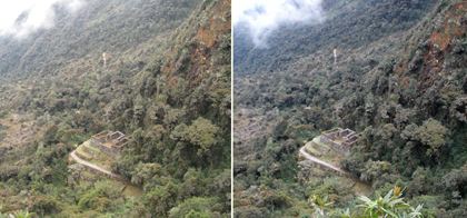
The Inca settlement Patallacta (2700 m), down where the Rio Cusichaca (included here) flows into the Urubamba.
The Inca Trail is seen ascending at right. Hugh Thomson presents modern views of Peruvian history in his
book "The White Rock". The left-eye view was taken by Joy Jonstone.
Question 18: Why include this difficult stereo-pair? (Answer 18)
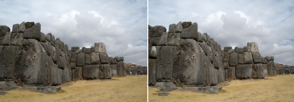
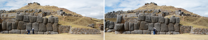
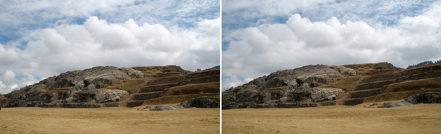
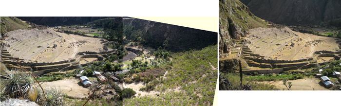
Sacsayhuaman, above Cusco, Peru (July 2008)
The ninth Inca Pachacuti (1438-1471) started the building of this fortress-temple.
There are three terraces built in zigzags like the teeth of a great saw (see the top picture),
for ease of defence. Upper level structures were destroyed. Compare views on Google Earth.
(back)
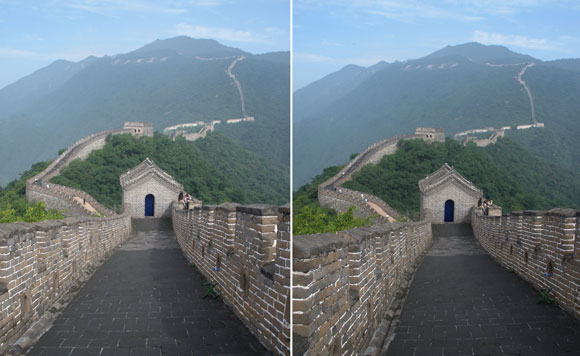
The Great Wall of China at Mutianyu north of Beijing
As may be verified from Google Earth, this stereo was taken looking NNW from 40.4407°N, 116.5593°E.
The oak leaves shown above were photographed a few hundred metres north of this location.
The modern Wall dates from the Ming Dynasty (1368-1644)
and stretches from the coast east of Beijing as far as Gansu Province.
Question 19: How far away is the inscription on the hillside; what does it say? (Answer 19)
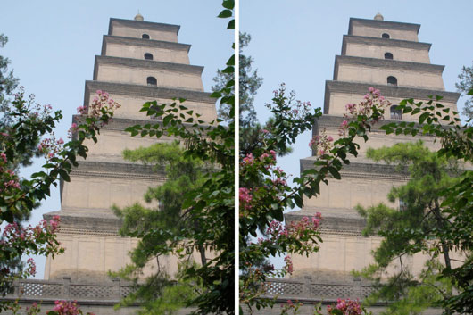
The Da Yan or Big Wild Goose Pagoda, Xi'an, China (rebuilt 701-4).
The pink shrub is probably Crepe Myrtle (Lagerstroemia indica)
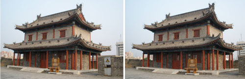
Sentry platform and rampart tower on the city wall of Xi'an, China
The wall dates from 1370. On it there are 98 defensive ramparts 120 m apart.
On a hired bicycle one may ride for 9.5 km around the top of the wall.
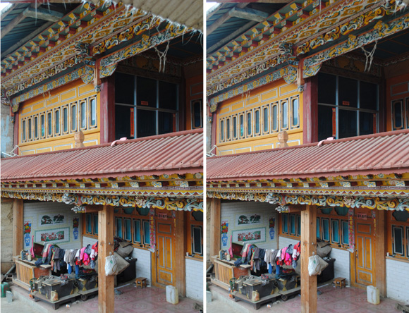
Tibetan house in the village of Geza, northern Yunnan, China.
(back)
A decorated roof at the Xuankong Si Temple
Dating from the 6th Century, it is built up on a cliff 65 km southeast of Datong, northern China
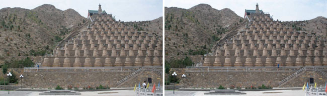
The 108 Dagobas, the largest Buddhist stupa group in China
On the Yellow River just upstream of the dam at Qingtongxia, Ningxia.
Renovated, they date from the 14th Century. Compare Google Earth at 37.8740°N, 105.9784°E
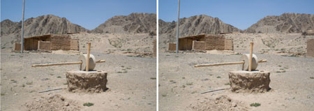
Mill wheel at a village near Beichangtan, on the Yellow River upstream from Zhongwei, China
This stereo invites you to grasp the long rod and get to work.

The Taj Mahal (January 1979)
Agra, home of the Taj Mahal, 200 km south of Delhi on the Yamuna river, was of equal status with Delhi in the
16th and 17th centuries, the time of the Moghul emperors. Shahjahan built the Taj as a permanent resting place
for his wife Mumtaz Mahal, who died in 1630 after giving birth to her fourteenth child. This Moghul
architecture seems suitably effusive and exuberant. The stereo shows the octagonal tower,
and three of the five domes upon it (with part of a fourth dome obscured); also the four surrounding minarets.

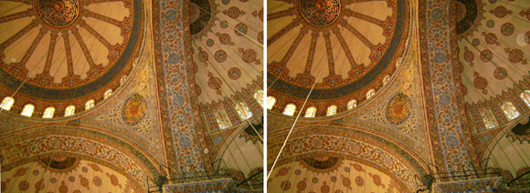
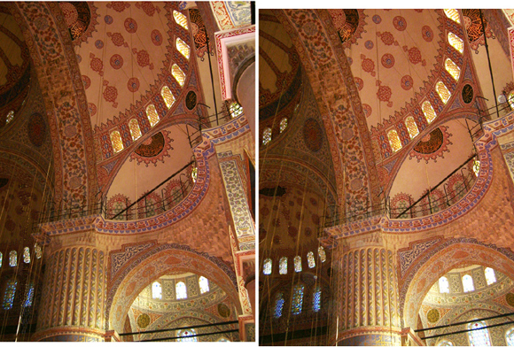
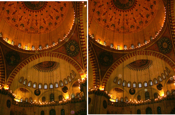
The Sultan Ahmed or Blue Mosque, Istanbul
The last great mosque of the late classical Ottoman period, completed in 1616
[The photos were taken on my first great EXPLORE tour (see purple8.html)]
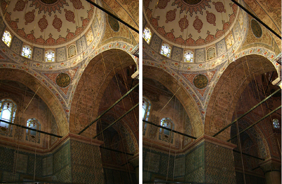
The Süleymaniye Mosque, Istanbul
Built on the order of Sultan Süleyman the Magnificent in the style of the Byzantine church Hagia Sofia,
it was completed in 1558.
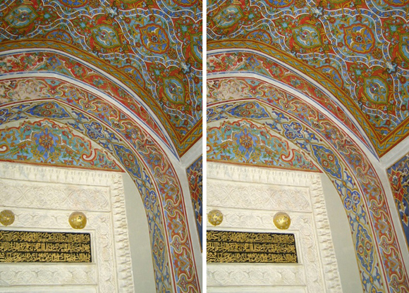
At the Hacibektaş Veli Museum
The wooden framing above an entrance door. The Arabic inscription reads: built
"by Abdullah bin Murad Yasinabad PreviousNext 960 (M.1553) in", according to the
Museum guide.
Haci Bektaş Veli was an Islamic spiritual leader and educator of the 13th century, who with science
and reason protected Turkish culture and language among the Anatolian people.
At the Hacibektaş Museum
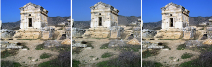
A part of the extensive Phrygian city of Hierapolis
Tombs of its necropolis are found over a wide area of hillside.
It was a cure centre that prospered under the Romans and Byzantines (Turkey, Lonely Planet Guide).
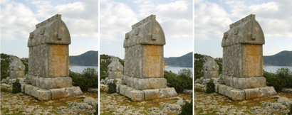 A Lycian tomb on the island of the village of Kalekoy (by the ancient city of Simena), Turkey.
This tomb has a base, a burial chamber and a rounded, crested lid.
Compare the nearby coastal topography of Kekova, below.
A Lycian tomb on the island of the village of Kalekoy (by the ancient city of Simena), Turkey.
This tomb has a base, a burial chamber and a rounded, crested lid.
Compare the nearby coastal topography of Kekova, below.
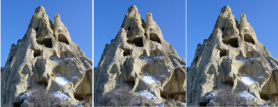 A tower of tuff (consolidated volcanic ash) in the Rose Valley, Cappadocia, Turkey.
Such towers are placed under Buildings because early inhabitants carved out dwellings within them: -
A tower of tuff (consolidated volcanic ash) in the Rose Valley, Cappadocia, Turkey.
Such towers are placed under Buildings because early inhabitants carved out dwellings within them: -
Frescos within a church inside rock (not the tower above) in the Rose Valley, Cappadocia
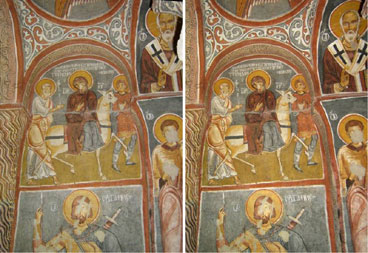
A church inside rock - Göreme Museum, Turkey
The churches were carved out of the rock by Christian monks between roughly 900 and 1200 CE.
The painting shows Mary, seated on an ass, accompanied by Joseph and a servant
on the road to Bethlehem
for the first population census by Caesar Augustus.
Question 20: What is the rock which allows such careful shaping of the roof? (Answer 20)
(back)
STEREOS OF ROCK FORMATIONS
Archaeology involves both buildings and rock formations: -
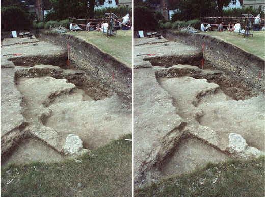
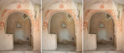
Guildford Castle, Surrey, England, 23 July 1992
The scene of a training excavation led by Rob Poulton of the
Surrey Archaeological Society,
which showed substantial evidence for an early 13th century building.
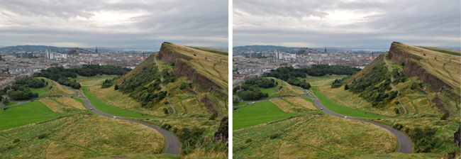 Ground-breaking early studies of rock formations were accomplished in Scotland. Very obvious from up on
the south side of Arthur's Seat in Edinburgh is the slope of the formation named for the Salisbury Crags.
Layers were deposited very gradually over millions of years in the Carboniferous period (of age ~330 Ma). The
layers of this formation now tilt downwards towards the east at some 20°. (Arthur's Seat was a subsequent
volcanic break-through of Carboniferous age.) The excellent introductory geology book "Scotland" by Peter Friend
(Collins, 2012) includes some brief explanations.
Ground-breaking early studies of rock formations were accomplished in Scotland. Very obvious from up on
the south side of Arthur's Seat in Edinburgh is the slope of the formation named for the Salisbury Crags.
Layers were deposited very gradually over millions of years in the Carboniferous period (of age ~330 Ma). The
layers of this formation now tilt downwards towards the east at some 20°. (Arthur's Seat was a subsequent
volcanic break-through of Carboniferous age.) The excellent introductory geology book "Scotland" by Peter Friend
(Collins, 2012) includes some brief explanations.
 Siccar Point is on the coast 50 km east of Edinburgh. Here in 1788 James Hutton closely observed the way that
rock formations of different character are separated by an unconformity. (In 1795 he published his famous
"Theory of the Earth".) On 4 September 2012 he was being followed diligently by Zoe Meldrum,
seen here taking notes on the geology. Greywacke sandstone strata of the Silurian period (444-416 Ma) were
tilted into the vertical, and an unconformity separates these from layers of Old Red Sandstone
[upper Devonian (416-359 Ma) or lower Carboniferous (359-299 Ma)] which now dip downwards to the west.
According to the notices by Scottish National Heritage the separation in time is ~55 Ma - perhaps 420 to 365 Ma.
The older strata have been eroded cleanly; it has been argued by
David Tyler
that this implies erosion of considerable vigour.
Siccar Point is on the coast 50 km east of Edinburgh. Here in 1788 James Hutton closely observed the way that
rock formations of different character are separated by an unconformity. (In 1795 he published his famous
"Theory of the Earth".) On 4 September 2012 he was being followed diligently by Zoe Meldrum,
seen here taking notes on the geology. Greywacke sandstone strata of the Silurian period (444-416 Ma) were
tilted into the vertical, and an unconformity separates these from layers of Old Red Sandstone
[upper Devonian (416-359 Ma) or lower Carboniferous (359-299 Ma)] which now dip downwards to the west.
According to the notices by Scottish National Heritage the separation in time is ~55 Ma - perhaps 420 to 365 Ma.
The older strata have been eroded cleanly; it has been argued by
David Tyler
that this implies erosion of considerable vigour.
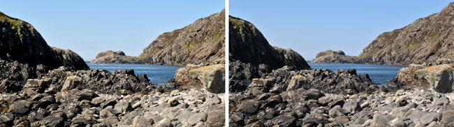
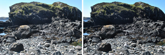
Photographs taken on the Scottish island of Arran are included in a
separate file, notably of Hutton's Unconformity at Newton Point,
and of a fulgurite at Corrie.
 Stories of Hutton are included in the geology book "Hutton's Arse" by Malcolm Rider (2005). He encourages people
to visit particular places in the Scottish Highlands. One of these is Knockan Crag,
located on the road north from Ullapool at National Grid Reference NC 191 094.
From the top downwards in the geological sections to be found here are Moine schist (of age 1000-900 Ma),
Durness Limestone (~500 Ma), Salterella Grit (~500 Ma), Fucoid Beds (~540 Ma), Pipe Rock (~540 Ma),
Basal Quartzite (~540 Ma) and Torridonian Sandstone (1200-850 Ma). Geologists at Leeds University have provided
a short explanation
of the rock sequence. Somehow older rocks appeared on top of younger. To the solution of difficult this puzzle Rider
devoted a chapter "2. Deep Scar: The Moine Thrust. The story of a bitter scientific controversy" in his book. Compare
the photos by D. J. Waters at Oxford University.
Compare also Locality 6.1 in "North-West Highlands of Scotland" (Goodenough and Krabbendam, 2011.
"The Oxford Dictionary of Geology and Earth Sciences" (Michael, Allaby, Ed.) is a book which gladdens the heart
with delight. (back to Brinscall)
Stories of Hutton are included in the geology book "Hutton's Arse" by Malcolm Rider (2005). He encourages people
to visit particular places in the Scottish Highlands. One of these is Knockan Crag,
located on the road north from Ullapool at National Grid Reference NC 191 094.
From the top downwards in the geological sections to be found here are Moine schist (of age 1000-900 Ma),
Durness Limestone (~500 Ma), Salterella Grit (~500 Ma), Fucoid Beds (~540 Ma), Pipe Rock (~540 Ma),
Basal Quartzite (~540 Ma) and Torridonian Sandstone (1200-850 Ma). Geologists at Leeds University have provided
a short explanation
of the rock sequence. Somehow older rocks appeared on top of younger. To the solution of difficult this puzzle Rider
devoted a chapter "2. Deep Scar: The Moine Thrust. The story of a bitter scientific controversy" in his book. Compare
the photos by D. J. Waters at Oxford University.
Compare also Locality 6.1 in "North-West Highlands of Scotland" (Goodenough and Krabbendam, 2011.
"The Oxford Dictionary of Geology and Earth Sciences" (Michael, Allaby, Ed.) is a book which gladdens the heart
with delight. (back to Brinscall)
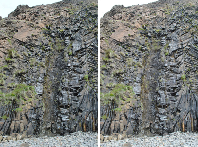
In this stereo at the top is a thick layer of big dark rocks (1);
next, also dark, is a distinct thin layer (2); next, in the middle, is a whitish layer of medium thickness (3);
next is a thin layer or layers with vegetation attached (4); at the bottom is a thick layer
of many different strata of similar appearance (5). 31 Aug 12.
Question 21: What rocks compose these appearances (1) to (5)? (Answer 21)
(back)
At Knockan Crag. Fucoid beds at NC 189 093 (?). 10 July 15.
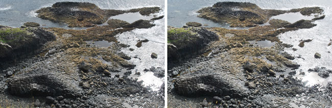
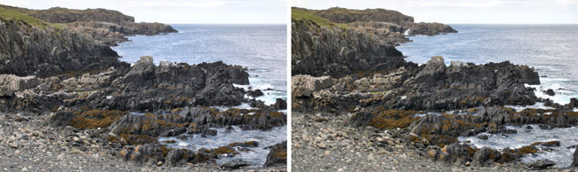
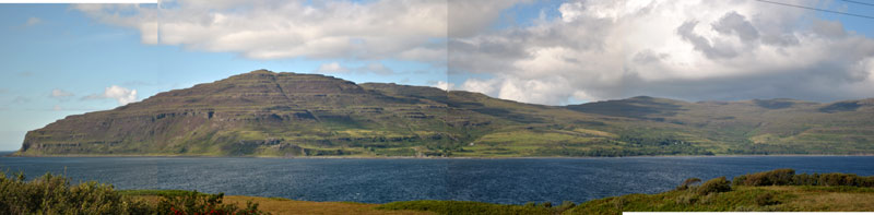 On the island of Mull, the western end of the Ardmeanach peninsula features the lava pile Bearraich (430 m).
Described by Peter Friend in his book "Scotland", this is a classic example of trap, or stepped, topography
resulting from Tertiary lava sequences of age 61-58 Ma. The panorama was taken looking northwards
across Loch Scridain from grid Reference NM 428 238. (Compare Friend's Fig. 128).
On the island of Mull, the western end of the Ardmeanach peninsula features the lava pile Bearraich (430 m).
Described by Peter Friend in his book "Scotland", this is a classic example of trap, or stepped, topography
resulting from Tertiary lava sequences of age 61-58 Ma. The panorama was taken looking northwards
across Loch Scridain from grid Reference NM 428 238. (Compare Friend's Fig. 128).
 MacCullough's fossil tree is at grid reference NM 4025 2781. (Compare Friend's Fig. 124.) This conifer,
12 m high with a bole of diameter 1 m, is "surrounded by columnar mafic lava that must have flowed
around it while the tree was still alive." (Friend). I wonder whether one could have stood under this tree
58,472,342 years ago, and whether one would have found that it stood higher above the ground
in those days.
MacCullough's fossil tree is at grid reference NM 4025 2781. (Compare Friend's Fig. 124.) This conifer,
12 m high with a bole of diameter 1 m, is "surrounded by columnar mafic lava that must have flowed
around it while the tree was still alive." (Friend). I wonder whether one could have stood under this tree
58,472,342 years ago, and whether one would have found that it stood higher above the ground
in those days.
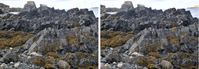
 The fossil tree is a mile from the point seen at the extreme left of the panorama. Along the western coast
occur many rock formations and cliffs suggesting rapidly cooled lava later exposed by the sea. This stereo
was taken at grid reference NM 406 271 looking down at the beach from the path along the coast.
(back)
The fossil tree is a mile from the point seen at the extreme left of the panorama. Along the western coast
occur many rock formations and cliffs suggesting rapidly cooled lava later exposed by the sea. This stereo
was taken at grid reference NM 406 271 looking down at the beach from the path along the coast.
(back)
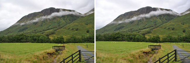 Scotland: Glen Nevis Estate (at grid ref NN 131 711), 29 Aug 12. A ribbon of cloud was moving at roughly
3 m/s down the valley on this rather showery day. I waited 12 seconds between the left and right-eye views,
so the cloud drifted roughly 36 m across my line of sight.
Scotland: Glen Nevis Estate (at grid ref NN 131 711), 29 Aug 12. A ribbon of cloud was moving at roughly
3 m/s down the valley on this rather showery day. I waited 12 seconds between the left and right-eye views,
so the cloud drifted roughly 36 m across my line of sight.
 The waterslide of Allt Coire Eoghainn off the south side of Ben Nevis at grid reference NN 165 695.
The granite of Ben Nevis is very hard and has no fissure just here to facilitate runoff.
(back)
The waterslide of Allt Coire Eoghainn off the south side of Ben Nevis at grid reference NN 165 695.
The granite of Ben Nevis is very hard and has no fissure just here to facilitate runoff.
(back)
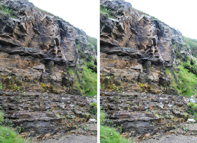
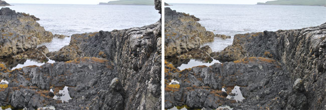
In 2013 I wanted to follow up leads given by Malcolm Rider in his book "Hutton's Arse", and hastened to Scourie,
where I found accommodation with Gerald and Penny at Scourie Lodge. They introduced me to Donald Fisher,
well-known Scourie geologist.
 Down at the pier of Scourie harbour I was struck by an unconformity quite as dramatic (to me) as Hutton's
Unconformity seen on Arran, and at Siccar Point near Edinburgh. Donald Fisher, geologist friend of Gerald
and Penny, told me that this assemblage was not so significant because the rocks were all of fairly similar
character, Lewisian gneiss. A longer baseline for the stereo would have been better, but the harbour wall is
not very wide.
Down at the pier of Scourie harbour I was struck by an unconformity quite as dramatic (to me) as Hutton's
Unconformity seen on Arran, and at Siccar Point near Edinburgh. Donald Fisher, geologist friend of Gerald
and Penny, told me that this assemblage was not so significant because the rocks were all of fairly similar
character, Lewisian gneiss. A longer baseline for the stereo would have been better, but the harbour wall is
not very wide.
 Here is a view of Scourie Harbour; the white house is Scourie Lodge. The photos were taken on each side of the road
from NC 155 447 on a baseline of ~8 m on 11 July 15.
Here is a view of Scourie Harbour; the white house is Scourie Lodge. The photos were taken on each side of the road
from NC 155 447 on a baseline of ~8 m on 11 July 15.
 Looking westwards at the Graveyard Dyke at Scourie at NC 148 448 on 28 May 2013. (A wave was breaking when I took
the left-eye view above.)
Looking westwards at the Graveyard Dyke at Scourie at NC 148 448 on 28 May 2013. (A wave was breaking when I took
the left-eye view above.)
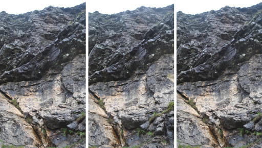
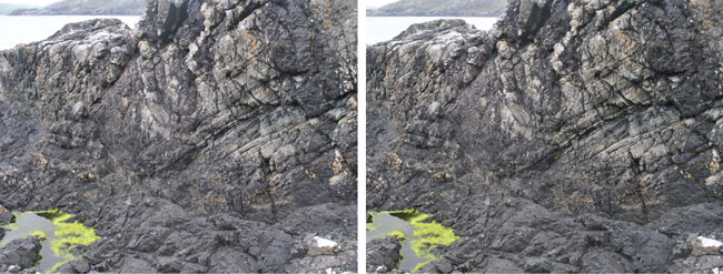 In 2015 the Scourie geologist Donald Fisher wonderfully gave me a tour of the Graveyard Dyke.
The above show the edge of the dolerite intrusion on the left, into the gneiss on the right. The dolerite
is fine-grained and the gneiss coarse. This is Locality 12.1 described by Goodenough and Krabbendam (2011).
The boundary is sharp. Note in stereo that the surface of the gneiss is not nearly flat as it may have
been when a crack in it was penetrated. Much of the dolerite has been eroded; the work-hardened gneiss
has endured longer.
In 2015 the Scourie geologist Donald Fisher wonderfully gave me a tour of the Graveyard Dyke.
The above show the edge of the dolerite intrusion on the left, into the gneiss on the right. The dolerite
is fine-grained and the gneiss coarse. This is Locality 12.1 described by Goodenough and Krabbendam (2011).
The boundary is sharp. Note in stereo that the surface of the gneiss is not nearly flat as it may have
been when a crack in it was penetrated. Much of the dolerite has been eroded; the work-hardened gneiss
has endured longer.
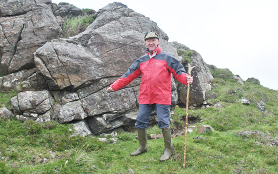
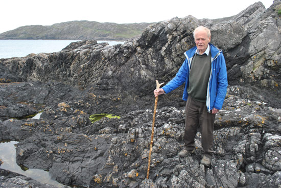 The above show Donald Fisher above and me below. Donald gave me his walking stick for the photo. I was not
prepared for this: I was miles away, computing like fury. My rather shabby "Sympatex"-lined jersey was usefully
protecting me from the breeze. I have not in years been able to find a replacement for this jersey.
The above show Donald Fisher above and me below. Donald gave me his walking stick for the photo. I was not
prepared for this: I was miles away, computing like fury. My rather shabby "Sympatex"-lined jersey was usefully
protecting me from the breeze. I have not in years been able to find a replacement for this jersey.
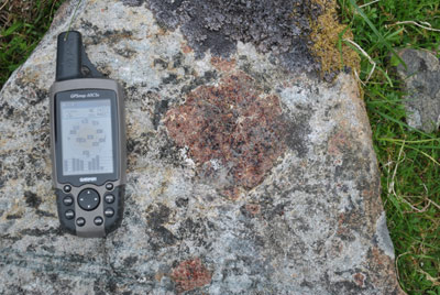 Garnets - little wine-coloured rhomboidal dodecahedra, nicely dated to age >~2700 million years - were
our prime target on this day, at Location 12.2 in Goodenough and Krabbendam (2011), probably unique in the world.
The grid reference reads NC 144 447; my Garmin is 15.6 cm long. We picked up cobbles of gneiss containing
numerous garnets with which to load my long-suffering Volksvagen ReG.
Garnets - little wine-coloured rhomboidal dodecahedra, nicely dated to age >~2700 million years - were
our prime target on this day, at Location 12.2 in Goodenough and Krabbendam (2011), probably unique in the world.
The grid reference reads NC 144 447; my Garmin is 15.6 cm long. We picked up cobbles of gneiss containing
numerous garnets with which to load my long-suffering Volksvagen ReG.
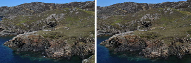
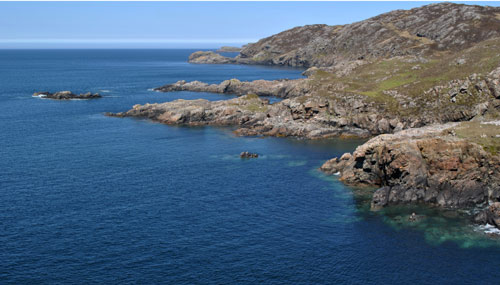 Walking up around the gorse over Scourie Harbour and westwards, to the left in the view above, one comes at
NC 152 451 to this view which shows Creag a' Mhàll in the distance. This is the Location 12.3 described
by Goodnough and Krabbendam (2011).
Walking up around the gorse over Scourie Harbour and westwards, to the left in the view above, one comes at
NC 152 451 to this view which shows Creag a' Mhàll in the distance. This is the Location 12.3 described
by Goodnough and Krabbendam (2011).
 Incursions towards the ESE are caused by dykes of basic igneous intrusion into fractures in the gneiss.
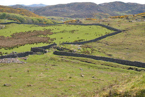 After crossing pastureland seen here NC 152 453 and descending to the beach ..
 one finds at NC 150 456, in the words of Malcolm Rider in "Hutton's Arse" (p 182), the Scourie dyke.
Dolerite of the igneous intrusion has been eroded into a trench some 40 m wide, here filled by the sea at
high tide. This is Location 12.4 described by Goodenough and Krabbendam (2011). 29 May 13.
one finds at NC 150 456, in the words of Malcolm Rider in "Hutton's Arse" (p 182), the Scourie dyke.
Dolerite of the igneous intrusion has been eroded into a trench some 40 m wide, here filled by the sea at
high tide. This is Location 12.4 described by Goodenough and Krabbendam (2011). 29 May 13.
 Black dolerite of the dyke; It seemed that evil consequences might follow from trying to knock
a piece off it. 29 May 13.
Black dolerite of the dyke; It seemed that evil consequences might follow from trying to knock
a piece off it. 29 May 13.
 The north flank of this dyke, showing near sea level the platform along which one may walk out along the
dyke's north flank of the trench left by the eroded basalt - best reconnoitred at low tide.
Intruded igneous rock is in the foreground. 29 May 13.
The north flank of this dyke, showing near sea level the platform along which one may walk out along the
dyke's north flank of the trench left by the eroded basalt - best reconnoitred at low tide.
Intruded igneous rock is in the foreground. 29 May 13.
 On the approach to this dyke I saw mysterious ripples in the turf, but the baseline of my stereo camera at
77 mm was not great enough to get a good stereo. The ripple orientation was across that of the dyke,
and the wavelength ~1 m. Grid reference NC 152 453. 11 July 15.
On the approach to this dyke I saw mysterious ripples in the turf, but the baseline of my stereo camera at
77 mm was not great enough to get a good stereo. The ripple orientation was across that of the dyke,
and the wavelength ~1 m. Grid reference NC 152 453. 11 July 15.
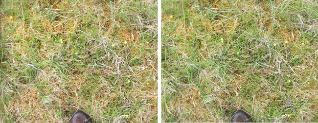 Walking home I photographed that most difficult of targets - grass and small flowers.
The grass is some 30 cm high. NC 153 452. 11 July 15.
Walking home I photographed that most difficult of targets - grass and small flowers.
The grass is some 30 cm high. NC 153 452. 11 July 15.
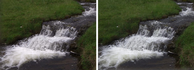 A small waterfall at NC 242 239, proper target for a pocket stereo camera. The baseline at 77 mm of the
Fujifilm 3DW1 stereo camera is not great enough for more distant views -
a great limitation for geology. 13 July 15.
A small waterfall at NC 242 239, proper target for a pocket stereo camera. The baseline at 77 mm of the
Fujifilm 3DW1 stereo camera is not great enough for more distant views -
a great limitation for geology. 13 July 15.
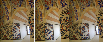
Towers of tuff in the Rose Valley, Cappadocia, Turkey
The green colour probably resulted from
chemical weathering
involving copper carbonates and hydroxide.
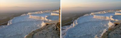
Travertine, calcium carbonate, shelves at Pamukkale, Turkey (Dec 2007)
The shelves are imitated by the brick structure in the foreground. The curative mineral waters gave
rise to the spa city Hierapolis. Note winter haze concentrated near the ground - all too common nowadays
on planet Earth. (back)
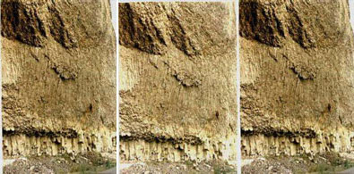
Overhanging Cliff, at Tower in the north of
Yellowstone National Park, Wyoming, USA
(Aug 1971)
Here we see grain structures of columnar basalt with pieces chipped away to leave jagged surfaces.
It is much easier to present a stereo-pair such as this than to try to describe the structures of the layers
with single photographs plus drawings and dimensions.
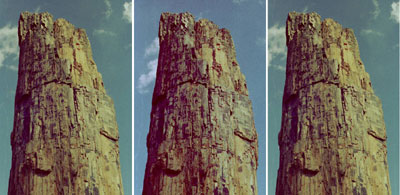
Petrified Tree in the north of Yellowstone National Park
The stump of a redwood still standing where it grew some 37 million years ago.
In each cell of the tree, silica from volcanic ash was deposited, petrifying the tree and creating an exact stone
replica. In stereo the central core of heartwood may be distinguished from the outer sapwood.
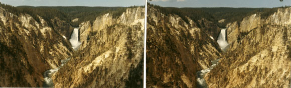
The Grand Canyon of the Yellowstone, Wyoming
Yellowstone Lake at 2360 m lies just south of the Continental Divide.
Draining it to the north is the Yellowstone River. It cuts through the spectacular Grand Canyon of the Yellowstone.
The Lower Falls, 94 m high, at the head of the Grand Canyon of the Yellowstone are shown in the stereo-pair,
taken near Artist's Point about 1 km to the east, on the south rim of the Canyon.
A baseline of roughly 100 m was available for taking the left and right-eye views.
Erosion has left innumerable fine structures in the walls of the Canyon, readily appreciated in stereo.
Question 22: What rock predominates in the Canyon?
(Answer 22) (back)
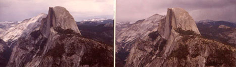
Half Dome (2700 m) in Yosemite National Park, California (June 1982)
It is seen looking east from Glacier Point at a distance of 4 km.
Glacial ice carved through weaker sections of the granite,
scouring out the rock but leaving harder portions intact.
The sharpness of the edges and the smoothness of the dome are most striking,
as though it were a piece of cheese.
 A baseline of about 10 m is available on Old Rag Mountain, Virginia,
an outlier from the Blue Ridge of the Appalachian mountains.
The rounded shapes of the rocks contrast with the delicate branches of the trees growing from crevices between them.
A baseline of about 10 m is available on Old Rag Mountain, Virginia,
an outlier from the Blue Ridge of the Appalachian mountains.
The rounded shapes of the rocks contrast with the delicate branches of the trees growing from crevices between them.
Question 23: What is the rock of Old Rag? (Answer 23)
Phil Wharmby, ..
.. and Lou Van Zwanenberg and Joy Jonstone (July 2008)
standing by the Yauca River Canyon close to the Pan American highway on the Pacific coast of Peru
(looking upstream and downstream respectively). See also a
view from space;
or Google Earth. The ladies and their surroundings have to be sought by some flexing of directions of viewing.
Chivay, Peru, local centre near the Cruz del Condor
Situated in a broad valley, the town is well above the Rio Colca in its canyon. Photos by Lee Chandler.
Question 24: How deep is the canyon below Chivay? (Answer 24)
Looking westward from near the top of Rigi Kulm (1798 m), Switzerland, 23 Aug 11
Seen across the Lake of Lucerne, Mount Pilatus (2122 m) is 19 km to the WSW.
My experienced companions declared that the visibility was excellent;
I contended that it must have been much better 150 years ago.
Our holiday is recounted in purple14.html.
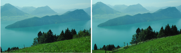
Looking southwestward towards Burgenstock (1128 m) on the descent from Rigi Kulm to Vitznau, 23 Aug 11
This stereo was taken from about 47.02902°N, 8.48065°E descending along the railway
with 2 s between right- and left-eye views.
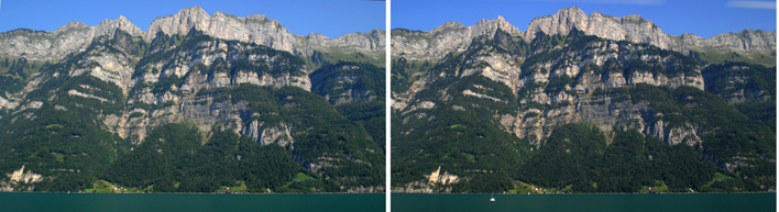
Wallensee, Switzerland. Looking northwards from the train from Zurich to Innsbruck, 25 Aug 11.
I waited 13 s between shots.
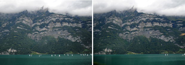
Wallensee, Switzerland. Looking northwards from the train from Innsbruck to Zurich, 27 Aug 11.
47.1117°N, 9.2319°E. (back)
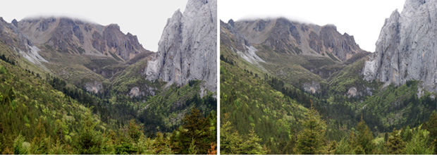
Northern Yunnan, China: Incised valley near
Tien Bao Shan, seen from ~27.7164° N, 99.9849° E (9 June 10)
Compare Google Earth and
photos by "jetsamoocow" on Panoramio
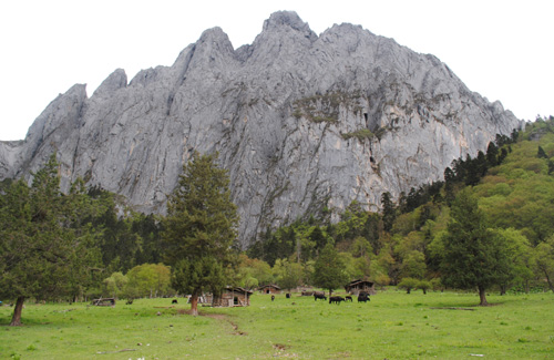
Cliff (discernible at right in the picture above) over a Tibetan farm in this valley
(at 27.661° N, 99.896° E):
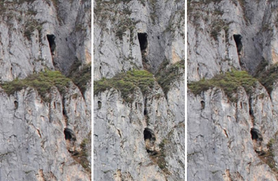 Enlargement of caves seen in the rock face. The baseline for this pair was roughly 30 m,
at places separated by 4 minutes of walking on the sloping land of the farm.
The computer program StereoPhoto Maker
has compensated for the distortions involved! One sees into the caves.
Be aware of exaggerations of the structural features
owing to the large angle subtended at the object by the rather long baseline.
(back to plants of southern Tibet)
Enlargement of caves seen in the rock face. The baseline for this pair was roughly 30 m,
at places separated by 4 minutes of walking on the sloping land of the farm.
The computer program StereoPhoto Maker
has compensated for the distortions involved! One sees into the caves.
Be aware of exaggerations of the structural features
owing to the large angle subtended at the object by the rather long baseline.
(back to plants of southern Tibet)
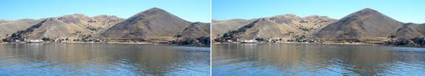
Hills NW of Puno, Peru, bordering Lake Titicaca (3810 m). An old steamship lies here:
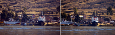
Lee Chandler photographed this ship with a telephoto lens.
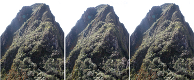 The granite peak of Huayna Picchu, Peru (2640 m), approaching from Machu Picchu.
The trail for its ascent goes across the front of this view and up the left - west - side.
The granite peak of Huayna Picchu, Peru (2640 m), approaching from Machu Picchu.
The trail for its ascent goes across the front of this view and up the left - west - side.
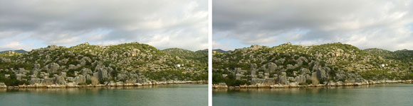
Turkish coastal topography at Kekova on the Mediterranean.
Stereo viewing reveals the rocky hillocks.
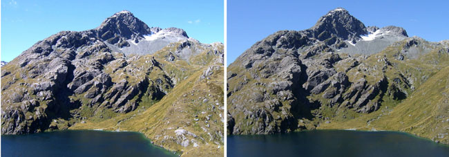
Mount Xenicus (1912 m) and Lake Harris (1220 m)
seen from the Routeburn Track on the South Island of New Zealand (back)
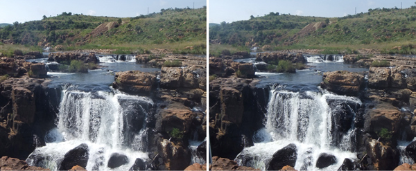
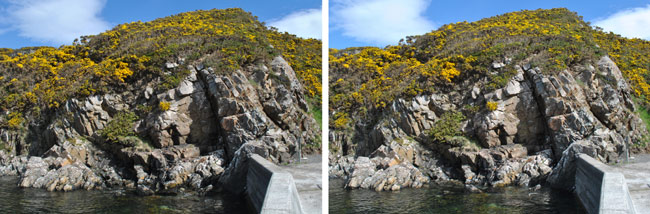
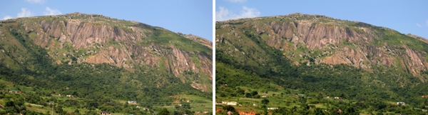
Waterfall on the Blyde River Canyon, Mpumalanga, South Africa
Taken with the Fujifilm 3DW1 stereo camera
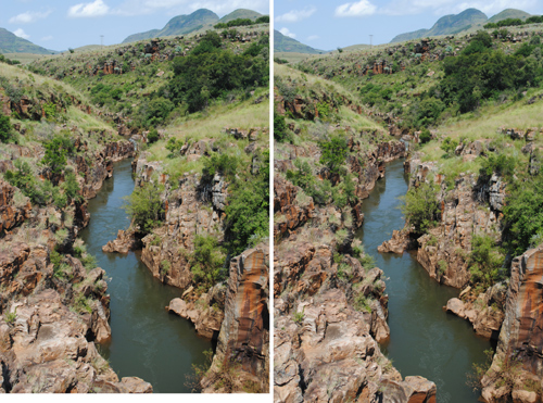
Looking southwards up the quiet Treur River, tributary to the Blyde River
Igneous rock at Blyde River Canyon, some of it extremely hard
Details of thin upward extrusions of igneous rock at Blyde River Canyon
A granite dome near Manzini, Swaziland
Question 25: The rock shows narrow vertical striations. Why is that? (Answer 25)
(back)
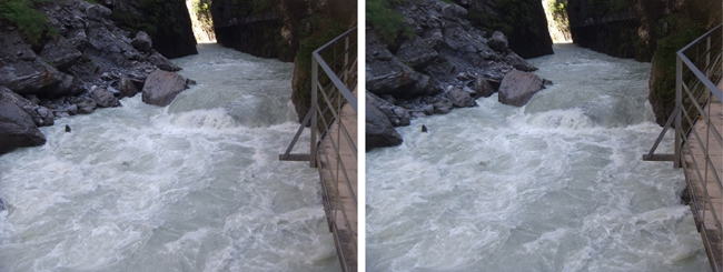
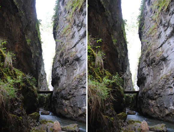
Looking upstream at the river Aare in its Aareschlucht near Meiringen, Switzerland. Taken using the
Fujifilm 3DW1
stereo camera
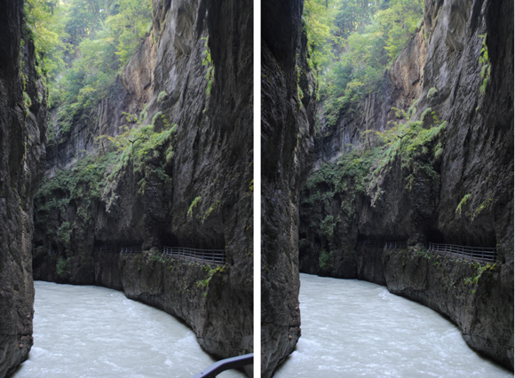
Looking upstream in the Aareschlucht using a baseline of one step sideways. (back)
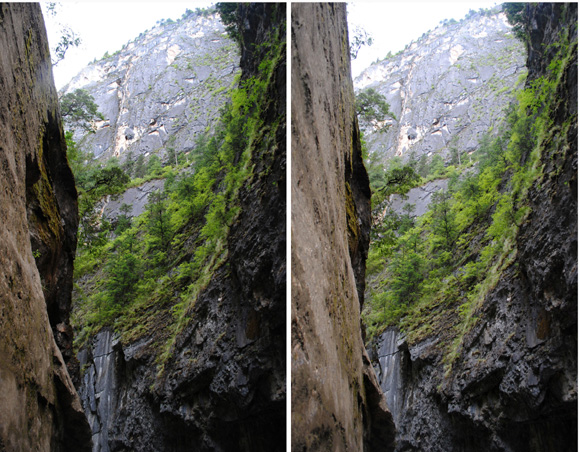
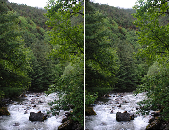
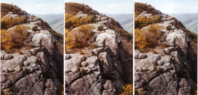
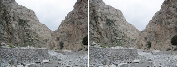
Looking upstream at the narrows of Birang Gorge of the Wengshui river, northern
Yunnan, China (16 June 10)
The river flows into the Yangtse. The gorge is celebrated for its botanical richness.
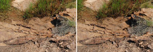
Birang Gorge narrows to 10 m roughly one kilometre upstream from the local highway. Looking upstream
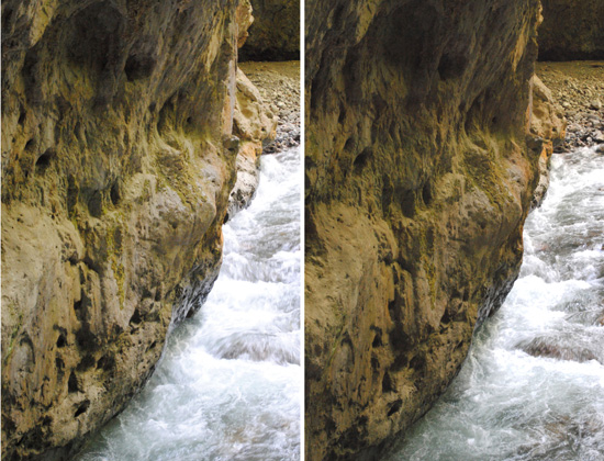
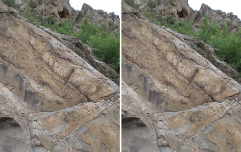
The waters of Himalayan rivers smooth the rock and erode it: undercutting at Birang Gorge. Looking upstream
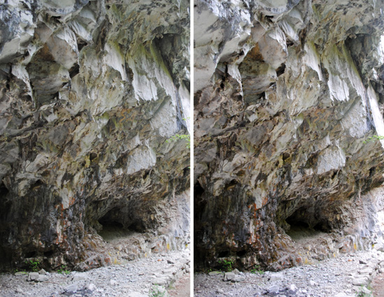
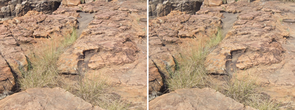
Sharp fractures of rock along the hiking trail at Birang Gorge
Caves like this in rocks and cliffs are locally quite common.
Question 26: What causes the smooth faces and sharp angles of the rocks shown here? (Answer 26)
(back to Birang forest)
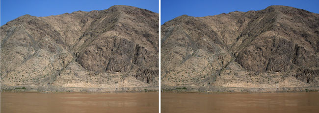
On the Yellow River floating downstream near Yemingshan, Ningxia Province, China.
About 25 km upstream from Zhongwei the Yellow River is at about 1100 m altitude,
and these small mountains are a few hundred metres higher.
Much of northern China is made from loess, wind blown silt;
these mountains have a smooth texture.
The valley of Helankou, Ningxia Province, China
Note the man-made walls confining the course of the (dry) river,
on the east foot of Helan mountain 45 km northwest of Yinchuan.
Question 27: What is the course of the riverbed here as it disappears out of sight? (Answer 27)
Rock engravings are found throughout the 300 km length of the Helan mountain range.
They are thousand(s) of years old (see the book by Paul G. Bahn,
"The Cambridge Illustrated History of Prehistoric Art", 1998).
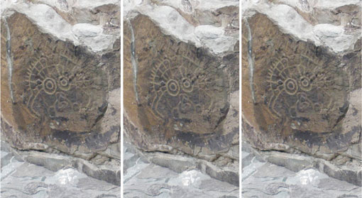
A Helankou carving possibly representing the Sun
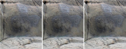
A Helankou group of figures
Helankou figures and faces, looking like casual graffiti
rather than sacred objects of reverence. (back)
STEREOS OF CLOUDS
Everyone should consider joining The Cloud Appreciation Society.
Its founder, Gavin Pretor-Pinney, has written a brilliant small book called "The Cloudspotter's Guide" (2006),
data and messages interlaced with stories.
In 1966 I joined the Stormy Weather Group
at McGill University (See purple3).
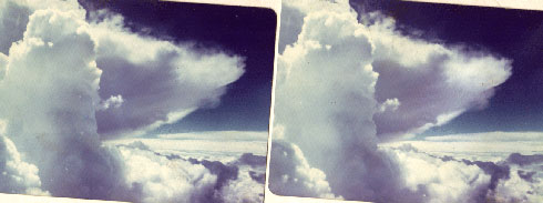
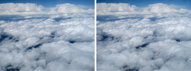
Cumulus over the plains of Alberta southeast of Red Deer, at altitude 4600 m
A typical young tower is shown on the left. The anvil has spread out from its predecessors.
It has an upper sunlit layer, and another separate thin layer in shadow.
Below flight level, 4600 m above ground, there is another layer at which cumulus towers have been
spreading out. At bottom right may be seen smaller clouds far below close to the ground.
The two views were taken as fast as I was able - a second or two - to give a baseline of about 100 m.
I used a wide-angle lens and a polarizing filter to darken the sky. Looking to SW. 9 Aug 76, 1400
Mountain Daylight Time.
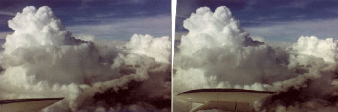
Cumulus clouds over the foothills of south central Alberta
Looking to NNE from 5200 m above the foothills of south central Alberta. A rising cumulus tower must be
accompanied by compensating subsidence somewhere.
The picture implies that this occurs mostly locally, at least for clouds of modest size:
the appearance of the rings of cloud remnants implies that they were held in place by weak stable layers,
then pushed aside by air moving sideways and downwards out of the way of the new cumulus. 2 Aug 76, 1813
Mountain Daylight Time. (Part winner of the James Paton Memorial Prize of the Scottish Branch of the Roy.
Meteorol. Soc., 1983)
Question 28: How much of the energy of cumulus towers goes into making waves: Does this view suggest anything?
(Answer 28)
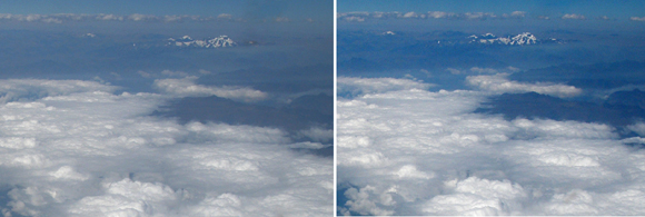
Cumulus and stratocumulus over the Andes, and icy mountain tops in clear air (by Lee Chandler)
Seen looking to S about halfway between Cuzco and Puerto Maldonado, Peru.
Fine structure may be seen through the depth of the cloud layer, and mountains just appearing through it.
Note the confinement of haze &/or smoke. 17 July 08, 1030 local time.
Question 29: Any other layers? (Answer 28)
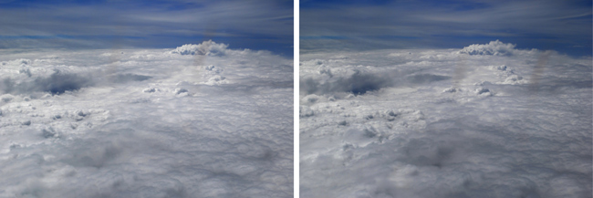
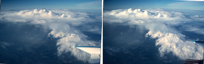
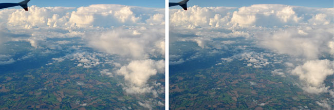
Clouds over northern France
These photos appeared dull when taken; colour and structure were brought out by use of Photoshop.
Flying from London City Airport to Zurich, to meet Atsumu Ohmura and
Gerd Gagette, looking to S, I waited 8 s between Right- and Left-Eye views. These clouds are structures of
low entropy: Nature is chaotic, and utilizes the
free energy of incoming sunlight. (See the references under
Vyacheslav Zakharov.) 22 Aug 11.
 On 14 Sep 15 Atsumu Ohmura and I flew out to Vienna, home town of
Gerd Ragette.
A cyclone was close to England's south coast. Atsumu flew out of Amsterdam.
Note that the stratocumulus was suppressed locally, next to an area of cumulonimbus.
150914.1422 UTC by Atsumu Ohmura, on a baseline of ~ 4 s between Left- and Right-Eye views.
Atsumu's photos suggest greater proximity to the centre of the cyclone than my stereos taken 3 hours earlier:-
On 14 Sep 15 Atsumu Ohmura and I flew out to Vienna, home town of
Gerd Ragette.
A cyclone was close to England's south coast. Atsumu flew out of Amsterdam.
Note that the stratocumulus was suppressed locally, next to an area of cumulonimbus.
150914.1422 UTC by Atsumu Ohmura, on a baseline of ~ 4 s between Left- and Right-Eye views.
Atsumu's photos suggest greater proximity to the centre of the cyclone than my stereos taken 3 hours earlier:-

150914.0741 with a baseline timed at 3 s between Right- and Left-Eye views,
fast to capture the nearby wisps of cirrus towards which we were ascending.
150914.0743 with a baseline timed at 5 s,
included to show dissipating cumulus with no shape,
and the layer of cumulus very roughly 1500 m off the surface

150914.0745 with a baseline timed at 5 s
Think of the gross directional asymmetries of radiation, both short- and long-wave,
bound to occur among these fields of cumulus (and stratus)
150914.0746 with a baseline timed at 6 s

150914.0759 with a baseline timed at 7 s
The cloud close below the aircraft is almost castellanus after instability has developed vertically
across it

150914.0842 with a baseline timed at 8 s
Far away to the east of the parent cyclone the clouds were more stratiform
150914.0844 with a baseline timed at 6 s
At the top of the troposphere local circulations occur which might repay systematic observational study.
I hope that my friend while at Oxford University, Professor Keith Shine FRS,
will have a student take notice.
A variety of cumulus and stratus over Mongolia
Looking to N from altitude 10 km close to UlaanBaatar, flying from London to Beijing
I waited about 5 s between Left- and Right-Eye views. Note in stereo the thin layer of patchy altostratus.
27 July 09, 0745 UTC.

High clouds over the Sayan Mountains of central Asia
Looking to SW from altitude 10.7 km, flying Beijing-London
Diffuse remnants of cumulus at different levels; dense new cumulus towers
For projections by computer of weather and climate, rates of heating and cooling are
found from the energy flows of radiation.
Downward flows of solar radiation are scattered by clouds.
From the earth, from clouds and from the air thermal radiation flows both upwards and downwards.
11 Aug 09, 0400 UTC
Question 30: Where were the principal cloud levels? (Answer 30)

For my summer visit home to see my mother, I paid $1813 for a flight on Concorde
from Dulles to Heathrow. I took the above stereo-pair when we were
at 46.3° N, 48.5° W, 55 kft (16.8 km), flying at Mach 2, 67 minutes into a 3 h 25 min flight.
Right- and Left-Eye views were taken 4 s (~2.4 km) apart. The crew reported the cloud tops at 38 kft (11.6 km);
we were looking down on the stratus fragments, rather than more usually upwards.
25 Sep 81, 1812 UTC.
This flight was unremarkable. The Concorde was only about half full of passengers. Its windows were not very
clean. We were shown the Machmeter and little else. However the stewardesses were charming and the alcohol with
which we were plied was of the highest quality, so one could not fail to enjoy the experience.

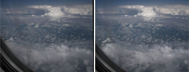
Clouds over the South China Sea at 12.2° N, 116° E, 7800 m looking to W. 11 Dec 78, 0849 UTC =
1633 local time, with 5 s between Right- and Left-Eye views.
During the winter monsoon air from the cold land mass of Asia flows out
over the South China Sea and heads SW towards Borneo and Singapore. It starts out cold and dry.
On its way it picks up heat and moisture from the underlying sea. (Here it has reached 12.2° N.)
Millions of tiny cumulus clouds are involved. Larger cumulus progressively increase in numbers;
the moist layer deepens.
Near the Equator much of this flow rises in tall cumulonimbus of the Intertropical Convergence Zone.
(Compare this to a similar view
taken a day later). My studies of monsoon clouds at the University of Virginia are described in
purple4.html.
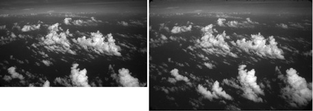
Boundary layer cumulus over the South China Sea at 8.8° N, 112.9° E, 6400 m, looking to N.
30 Dec 78, 0347 UTC = 1119 local time.
A pattern like this was recorded at
1504 on 17 Dec
Question 31: What caused the fairly rare cloud patterning manifest here? (Answer 31)
Clouds (entropy sources) over the east coast of Borneo at 10° S, 109.3° E during
the Winter Monsoon Experiment, looking to N.
Variety in distances from the viewpoint is brought out by stereo viewing -
also the differences in texture between old and new clouds. 6 Dec 78, 0753 UTC = 1510 local time.
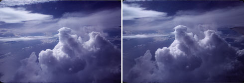
Cumulus towers close to the west of Sumatra
Looking to W over the Indian Ocean at 5.4° N, 93° E, 7470 m during the Winter Monsoon Experiment.
The highest tower had just pushed its way upwards, displacing air in its way.
A thin layer of moist air had condensed in this displaced air, to form a curved cap of pileus cloud.
Note evidence of light winds all the way upwards from the surface, which was unruffled and shiny.
9 Dec 78, 0824 UTC = 1436 local time. (Part winner of the
James Paton Memorial Prize of Scottish Branch of the Roy. Meteorol. Soc., 1983)
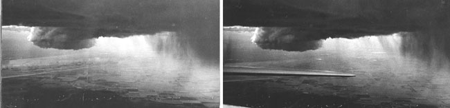
Cumulus updraught area near Sylvan Lake, Alberta, Canada
The pedestal was at 8850' = 2700 m; flight altitude 12000' = 3660 m above the farmland. The updraught was 2 m/s,
rising to 3 m/s on exit. Note the variety at small scales in the shafts of precipitation. StereoPhotomaker showed
errors on attempts at processing, after use of Photoshop 7 to eliminate the tailplane in the Right-Eye view.
4 July 76, 1722 local MDT.
Other updraft areas from the same storm formed part of Warner (Weather, June 1983) which won
the James Paton Memorial Prize of Scottish Branch of the Roy. Meteorol. Soc., 1983

Clouds over the Java Sea near the Equator
Seen at 3.8° S, 109.4° E, 3500 m, looking to WSW. The clouds were nearly vertical,
showing that vertical shear of the wind was slight.
There were several distinct stable layers at which fragments of cloud came to rest.
Note directionality near the surface. It seems that near-surface winds were from roughly NW, backing with height.
Note fine structure in the cirrus aloft. 6 Dec 78, 0527 UTC = 1244 local time.
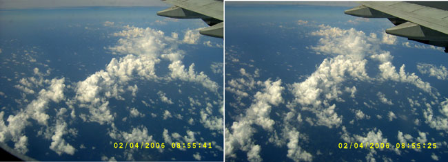
A circular cell of cumulus convection southeast of the Andaman Islands
Taken on the way to Kuala Lumpur for a Winter Monsoon Experiment reunion of meteorologists.
In April winds over the Bay of Bengal are light enough for autonomous organizations of clouds to appear,
which show a wealth of informative detail. At longitude 95° E, 0855 UTC corresponds to 1515 local time.
(see Warner, 2015)
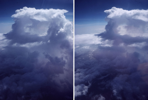
A dissipating cumulonimbus over the Bay of Bengal
Seen all by itself from 11.6° N, 90° E, 9100 m. A monsoon depression was growing vigorously 800 km
to the north; this cloud was situated in the westerly monsoon flow in the central Bay.
The partial stereo shows that much of the cloud consisted of streamers of precipitation.
At the top there were small (shallow) cumuliform towers,
and narrow cumulus towers may be seen at low levels. 5 July 1979, 0922 UTC = 1522 local time.
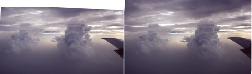
Tall cumulus seen from 22.4° N, 88.5° E, 4300 m on approaching Calcutta
The vigorous circulation of the monsoon depression was to the east and south
(see the page bay.html). Note the haze at low levels, and thin layers of stratus.
5 July 79, 1124 UTC = 1718 local time.
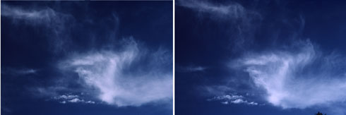
Tufts of cirrus drifting over Haslemere, Surrey
One can take stereo pairs of clouds from the ground. Instead of flying past them in
an aircraft one can wait for them to drift by in the wind: the camera should be aimed
directly across the direction of motion of the most interesting clouds. The clouds were drifting from
the southwest and were photographed looking to NW as they drifted from left to right. The interval
between taking the pictures should be such that the clouds change in direction by about 4°, with the
camera aimed continuously at the center of interest. If the wait is too long, the clouds may evolve too much.
Looking upwards at an elevation of roughly 30°, the Left-Eye view was taken 40 s after the
Right-Eye view. 15 Nov 86, 1042 UTC.
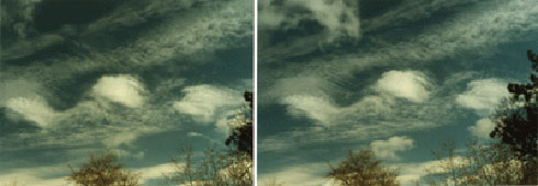 This stereo pair was taken looking to N from Grayswood Hill in Surrey.
The motion of dense white cumulus (one of them missed) was from the WSW. The altocumulus
cloud drifted more slowly across the field of view, so its greater height is revealed in the picture.
I waited 24 s between Right and Left-Eye views. 14 Apr 90, 1015 UTC.
This stereo pair was taken looking to N from Grayswood Hill in Surrey.
The motion of dense white cumulus (one of them missed) was from the WSW. The altocumulus
cloud drifted more slowly across the field of view, so its greater height is revealed in the picture.
I waited 24 s between Right and Left-Eye views. 14 Apr 90, 1015 UTC.
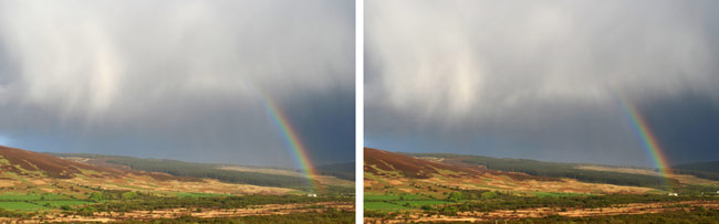 A rainbow and virga seen while crossing Arran, Scotland, from Machrie to Brodick. 22 May 13, 2004 UTC.
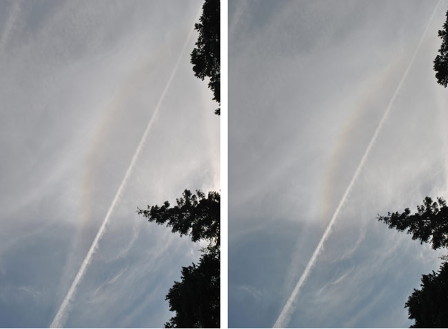 A 22° halo, plus Cs, plus contrail Cs seen from Thirlestane Court, southern England, looking
upwards and to the east.
Viewing in stereo suggests that the natural (?) Cs was higher than the contrails. With a delay between views
of 21 s the effect is slight: velocities and altitudes of both of the Cs were comparable. Cloud movement was
from the west at roughly 15 m/s. Fair weather cumulus moved at roughly 6 m/s from 220°
(later backing to 260° at 1344 UTC). The halo,
with the Sun, did not move significantly, so its apparent altitude was about the same as that of the trees.
Gavin Pretor-Pinney has written about the warming effect of anthropogenic Cs in "The Cloud-Spotter's Guide"
(The Cloud Appreciation Society, 2006).
Current research interest is on the effect of climate change on aviation rather than the other way round.
A 22° halo, plus Cs, plus contrail Cs seen from Thirlestane Court, southern England, looking
upwards and to the east.
Viewing in stereo suggests that the natural (?) Cs was higher than the contrails. With a delay between views
of 21 s the effect is slight: velocities and altitudes of both of the Cs were comparable. Cloud movement was
from the west at roughly 15 m/s. Fair weather cumulus moved at roughly 6 m/s from 220°
(later backing to 260° at 1344 UTC). The halo,
with the Sun, did not move significantly, so its apparent altitude was about the same as that of the trees.
Gavin Pretor-Pinney has written about the warming effect of anthropogenic Cs in "The Cloud-Spotter's Guide"
(The Cloud Appreciation Society, 2006).
Current research interest is on the effect of climate change on aviation rather than the other way round.
1 Aug 15, 0736 UTC.
Question 32: What weather was to be expected? (Answer 32)
 A bonfire - ideal target for the Fujifilm stereo cameras. The flame is too hot to yield any smoke.
Note the scale sizes of the little pyrocumulus. 3 Aug 15.
A bonfire - ideal target for the Fujifilm stereo cameras. The flame is too hot to yield any smoke.
Note the scale sizes of the little pyrocumulus. 3 Aug 15.
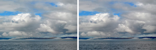 Sea mist and clouds seen from NR 922 519 on the ferry crossing from Lochranza to Claonaig, Scotland,
26 May 13, 1056.
Sea mist and clouds seen from NR 922 519 on the ferry crossing from Lochranza to Claonaig, Scotland,
26 May 13, 1056.
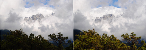
Small cumulus drifting slowly in front of Jade Dragon Mountains, looking roughly to W.
Yunnan, China.
The clouds drifted slowly from right to left (from very roughly N).
A wait of 18 s was about right here. 6 June 10, 0234 UTC = 0915 local time
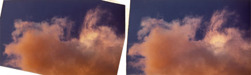 Cumulus cloud over Morgedal, Norway. Seen looking vertically upwards, blobs and filaments on
the flank of this cloud have been dispersed by turbulent eddies. Stereo viewing brings out the fine texture
of the cloud elements, and their spread in height above the camera. 14 Sep 72, sunset.(back)
Cumulus cloud over Morgedal, Norway. Seen looking vertically upwards, blobs and filaments on
the flank of this cloud have been dispersed by turbulent eddies. Stereo viewing brings out the fine texture
of the cloud elements, and their spread in height above the camera. 14 Sep 72, sunset.(back)
TAKING STEREO-PAIRS
MOUNTING STEREO-PAIRS
For details please see
About Nine Tries at Stereo-Pairs:- Heaven
An excellent program called StereoPhoto Maker is now available:
http://stereo.jpn.org/eng/stphmkr.
I hank Tony Bignell for introducing me to this.(back)
EXTERNAL LINKS
This website uses www.google.com/analytics.
Google Inc will record users' activities (see GA terms of service, 8.1)
Gale Rhodes gives an eloquent introduction to stereo viewing - essential for structural chemists - at
spdbv.vital-it.ch/TheMolecularLevel/0Help/StereoView.html
I thank Alexander Klein, Treasurer of the
International Stereoscopic Union, for pointing to an elegant stereo of
an interesting chemical.
Boris Starosta presents superb cross-eye art work at
www.starosta.com/stereo.html
Images of Mars may be found at
www.stereoscopy.com/mars/
Answer 1: Roughly 20 times the size of a leaf - 60 cm. (back)
Answer 2: 5. They are deciduous plants; most evergreen rhododendrons have 10 or more stamens.
See David Millais' colourful article "Tubular Belles" in The Garden, May 2011,
published by the Royal Horticultural Society. (back)
Answer 3: Groups of several leaves radiate from points along the woody stems. As described by Chinese authors in
Flora of China 10: 512-4, 2010,
leaves of length 10-25 cm are 3-11 foliolate. (back)
Answer 4: The spathe is the large striped bract which encloses the spadix -
the flower spike which here resembles an elephant raising its trunk. This combination is a distinguishing feature of
all aroids - members of the Araceae or Arum family. [See the Glossary of Roy Lancaster's 3 kg tome
Plantsman's Paradise Travels in China, Garden Art Press, 2008.] (back)
Answer 5: I do not know, and would like you to find out and tell me. (back)
Answer 6: The Himalayas offer a great range of opportunity for plants, so many different ones have evolved,
and strikingly individual structures make possible recognition by pollinators. (back)
Answers 7: Roughly 300 m; and roughly 100 m. (back)
Answer 8: It is a gall, due to insect larvae, mites or fungi. Compare
Cyttaria.
(back)
Answer 9: The thistle has six leaves, counting a small one just right of centre.
The nearest leaf has been damaged. (back)
Continuation 10 of the imaginary address: BECOSDERIS, VUNAS, PERORZ (back).
Answer 11: Riser heights were ~ 16 cm, but the step at the bottom was ~ 47 cm
to a stable footing because the ground slopes steeply. back).
Answers 12: A grass snake, most likely; roughly 30 cm (2'6"); because the adder adder handkerchief.
We do have mice and voles for prey, and lately I have made an interesting compost heap by throwing veg peelings
et alia on to a new veg area (at National Grid Reference 8882 3610);
we have a small pond ˜15 m to the north. (back)
Answer 13: This elephant was large and solitary, with a wide forehead and wide tusk base;
thanks to Noa Pinter-Wollman (see her early publications).
See also the photos by Trevor Ashenden
which help to affirm that he was male by showing him more in profile. (back)
Answer 14: This view shows the east half of the symmetrical south front
(compare the Astrophysics Department image).
Allan Soedring (architectural photographer)
also shows very beautifully that the extension seen comprised 5 bays, doorways and windows,
presumably first used by astronomers. I thank Allan for his help. (back)
Answer 15: My guess is that it is a hospital. (back)
Answer 16: 230 m. (back)
Answer 17: About 470 m. Winay Wayna is at around altitude 2620 m, the Urubamba at 2150 m.
(back)
Answer 18: It shows how the central stage of this major settlement was raised above its surroundings.
(back)
Answer 19: 1.4 km; "Faithful to Mao lord chair": Faithful to Chairman Mao.
On Google Earth may be seen other photos which show these 5 Chinese characters more clearly. They are
numbers 1430, 63, 288, 80, 662 in the list by Patrick Zein.
Thanks to Zoe for her help. (back)
Answer 20: Eruptions some 2 million years ago of the volcanos Erciyas Dag, Hasan Dag and Akdag
covered an area of about 11000 sq. km with pyroclastic ignimbrite, which solidified into andesitic tuff,
deep homogeneous layers which were covered by andesitic and basaltic lavas 2 to 1 million years ago
(See UN Environment Programme).
(back)
Answer 21: Probably: (1) Moine schist, down to about 2/3 of the height of this view;
(2) maybe Moine mylonite (heavily worked) in a very thin and possibly here non-existent layer;
(3) Durness limestone; (4) Salterella Grit & Fucoid beds; (5) Basal quartzites.
Thanks to Phillip Holmes for information. (back)
Answer 22: Rhyolite, an extrusive igneus rock high in silica and colourful after transformation
by chemical weathering. (back)
Answer 23: Granite from the Grenville orogeny accompanying the appearance of Rodinia ~ 1 billion
years ago (see the USGS) article.
(back)
Answer 24: 40 m; Chivay is at 3640 m and the Rio Colca at 3600 m. (back)
Answer 25: Probably because springs of water emerge at the tops of hills in this area
where molten rock rose slowly to the surface. (back)
Answer 26: This appears to be an example of "fluting" of limestone carved by flows of water
(see the article "
Geology and Geography
of the Great Bend of the Yangtze Tiger Leaping Gorge"). (back)
Answer 27: It bends to the left and then to the right between the cliffs about 150 m away.
(back)
Answer 28: The lower ring might mark the crest of a gravity wave expanding radially; the texture and
details suggest revived convection. Most of the energy of clouds goes into moving around water and air.
(back)
Answer 29: Above the levels of the icy mountain tops, the stratocumulus seen in the background
appears to have been at close to flight level. (back)
Answer 30: There was a cloud layer close to flight level (at ~ 10.3-10.7 km).
Two other stratiform patches in the foreground were a few km lower; and there were cumulus here and there near
the surface.
Computing the upwards and downwards flows of radiation through such fields of clouds
will always be an artistic sort of science. (back)
Answer 31: Static instability yielded the narrow castellanus towers. A stable layer very
close to
the surface allowed patterning by wave propagation. Winds turned with height because friction slowed the wind at
the surface, while a pressure gradient acted in another direction. The corresponding
tephigram is named "e30tef6". (back)
Answer 32: Backing winds mean cold air advection which means post cold-frontal clearing.
With small-scale variations, this is what occurred. Next morning we had fog. (back)
POLITICS, PHILOSOPHY, ECONOMICS (PPE)
i.e. SCIENCE OF POWER
Each of us individually should Care for the whole planet rather than just self, family or nation. As we become more
knowledgeable about ourselves and other creatures I hope that we shall perceive our true place in the world.
Sir David Attenborough ended his Natural World film "Cheeky Monkey" with the words
".. what makes us human isn't just human after all". The anthropocentric view that mankind is unique must surely
be abandoned. With Dr Denise Herzing,
we should learn how to talk with dolphins in their own language - and, like Mexicans, learn to enjoy the
massive wisdom of grey whales. (First we'll have to apologize for a number of gross abuses.)
It has surprised me that members of homo sapiens mostly feel so insecure that we must
avoid talking about politics, religion or sex because of the dangers of causing offence. Ann Widdecombe,
British national treasure, pantomime enthusiast and passionate Catholic, recently made a film shown on the
British Broadcasting Corporation exploring treatment of religion by comedians, Marcus Brigstocke
among others. Ann asked repeatedly whether giving offence - hurting people - mattered. Yes, but ...
Marcus graciously acknowledged that Ann's hurt gave him pause and the film ended with him making her laugh.
For me it's clear that "Sticks and Stones
may break my bones / But words will never hurt me". But that robust attitude is no longer generally accepted!
"All is Vanity" saith the preacher - a delusion. But a belief in nothing won't do: we need some sort of
Modus vivendi. For me the
"CARE religion" constitutes a Superior Operational Delusion (SOD) that can serve a person well.
[Try the exclamation "SOD that!"]. Be kind to others: be kind to yourself. Perhaps the prevailing
lack of kindness, of (Hindu) tolerance, goes along with terror
of an unknown Fate. The philosophy espoused here favours free speech (edgy, exciting, inconsiderate) over
tact (servile, boring, polite). If material on this web page is offensive, please be kind, make allowances
for limitations, click on "back" somewhere and move on to other material.
Reactions are often angry when I press arguments about
culling of populations - "not my problem". Too often an injunction such as "Don't think that it's
impossible to save the economy" leads merely to an absence of any thought at all.
We tend to be too tabloid (crudely: weak-minded).
A tabloid voyeur ogles at extremes of emotion displayed by others - and should get a life!
Imagine whither we might progress if thinking by adults was fun.
Of course it's not such fun if one is on a "nice little earner" as are so many homo sapiens
these days, cozy in their cliques. [In contrast, one May get into a close and
tight-knit cliquelet like a group of climbers or racers or musicians - sublime!]
On Arran in Scotland, a manifesto
 by Marvin Elliott, sculptor, seen with Bob:
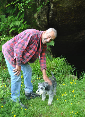
Marvin Elliott showed me layered deposits containing seashells
on their undersides, plus other interesting formations up in the steep hillside above his workshop
Instead of worshiping authority, I think that we should think for ourselves and lead by example - that we
should have the capacity for happiness solely within ourselves, on the basis that if you love something,
it's yours. Of course you're willing to share it with everyone else who loves it.
You love your planet; so if you feel sad, it's never for very long.
Any individual can lead - by example and not necessarily from the front!
"What sort of an idea are you"? asked Salman Rushdie in his great novel The Satanic Verses.
Some little kids know when their smiles make a difference, but millions have no
(TOtally Brilliant) Ydea of their raw power.
(back)
I'm just a poor boy nobody loves me.
He's just a poor boy from a poor family,
Spare him his life from this monstrosity.
Freddy Mercury's Bohemian Rhapsody is a great song (very difficult to sing). [William
Godfree's words
were used for the show called "Jubilee Showstoppers" (June 2012) chosen by
Haslemere Players.] Lead guitarist of the rock band Queen,
Dr Brian May, has long been a member of the
Stereoscopic Society; he and
Elena Vidal are shown in the Journal of 3D Imaging, Autumn 2009, Number 186.
What greater recommendation can there be to take an interest in stereos? Please note that swear words
can no longer be used, and some sentiments expressed should no longer be entertained by
a properly robust individual. HMS, Haslemere Musical Society,
commands my loyalty. Our leader is James Ross, Chorus Master
Tom Lydon, and accompanist
Clive Osgood, all masterful at
generating collective enjoyment from groups of very variable talent. Very gratifying it is after a long
show to venture to a Sublime Soprano Soloist a respectful compliment, and receive in return a glorious
smile. Conscientious music practice is very rewarding.
The following poem was originally published by the Haslemere Herald
(110708ppe.html)
Your time is coming up - you've had it chum.
Not long - then ashen white and numb.
So gradually the realization mounts
that smile upon a face is all that counts.
No need to feel inadequate - or doubt;
no need to throw your weight around - or shout.
Your misfortunes and your triumphs matter not.
It's just some happy smiles - and that's the lot.
Fading like the Cheshire Cat -
the smile's not gone and that's not that;
Alice remembers: she smiles too -
and others do - and so do you.
Ripples spreading in a pond
reach outwards unto tout le Monde
and so with our divinity
we go out to infinity
A smile is a manifestation of consciousness - awareness - understanding.
Stereo viewing enhances awareness of the wonders of nature. (back)
Illustrated below, small cards like bookmarks measuring about 105 by 55 mm, to facilitate
learning, can be provided. (back)
 clouds
rose
clouds
rose
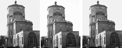 Radcliffe
pony
birch
Old Rag
Radcliffe
pony
birch
Old Rag
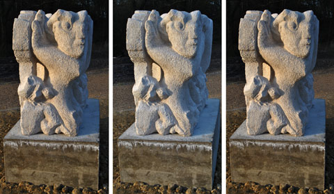 stone
stone
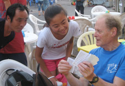
Not much money yet; lots of fun: Zhongwei, 1 Aug 09, by Carol Penn (back)
Charles Warner: Curriculum Vitae
Date of birth: 1 August 1938. Nationality: British. Marital status: Single
Work experience and education
Lately: Reading, writing and arithmetic
Jan - Apr 01: Research on rain with T. N. Krishnamurti at Florida State University, Tallahassee
Sept 87 - Jan 90: Senior
Scientific Officer at the Meteorological Office
Worked on the UK weather radar network
Jan 87 - Mar 87: Supply teacher of mathematics. Woolmer Hill School, Haslemere
Nov 84 – June 86: Research assistant in satellite meteorology at the Hooke Institute
for Atmospheric Research, the University of Oxford
Mar 77 – Aug 84: Research assistant professor. Cloud photogrammetry
at the University of Virginia, Charlottesville
July 75 – Mar 77: Research associate. Studies of Alberta hailstorms
at McGill University, Montreal
Mar 72 – July 75: Post-doctoral
research fellow. Radar meteorology at the
Dept. of Electronic &
Electrical Engineering, the University of Birmingham, UK
Feb 66 – Feb 72: Student and
research assistant at McGill University, Montreal.
Ph.D. 1971: Visual and radar aspects of large convective storms
M.Sc. 1967: Measurement of snowfall by optical attenuation
Sept 65 – Jan 66: Crossed the Atlantic under sail, with three others
Sept 63 – Sept 65: Research metallurgist. Studied compounds of Platinum at
Johnson Matthey Research Labs., Wembley
1960 - 1963: St. John’s College, Cambridge. Natural Sciences Tripos
Part I (1962): Class II Division I
Part
II (1963): Class II Division II in Metallurgy
B.A.(Hons). M.A. awarded in 1967
1956 – 1961: Saunders-Roe Limited, East Cowes, Isle of Wight,
and Isle of Wight Technical
College
Completed apprenticeship in Mechanical Engineering
Obtained ONC
(1957) and HNC (1959) of the Institution of Mechanical Engineers
1951 – 1956: Student at Radley College, Abingdon. Mathematics and Physics to ‘A’ level
Professional Memberships
Fellow, Royal Meteorological Society
Member, American Meteorological Society
Member, American Geophysical Union
Prize
The 1983 James Paton Memorial Prize of the Royal Meteorological
Society, Scottish Branch, for photographs published in the article
‘Stereo-pair photographs of cumulus clouds’, Weather, 38, 178-182. (back)
Refereed publications (plus selected reports: good homes are sought for factual reports dating
from 1982-6; also for MONEX data and cloud photo collections, with a view to continuation of this kind of work).
Please, if you like it, link with it
Application of stereo-photography to botany. Journal of 3D Imaging, 206, 30-34, 2016,
The Stereoscopic Society.
Properties of clouds discerned from stereo-pairs. Journal of 3D Imaging, 202, 31-3, 2015,
The Stereoscopic Society.
Stereo-pair photographs from a surface vantage point. Weather, 61, 135-6, 2006.
(back)
Entropy sources in equilibrium conditions over a tropical ocean.
J. Atmos. Sci., 62, 1588-1600. 2005.
(back)
Stereo-pair photographs of clouds. Weather, 58, 84-9.
2003. [Compare with the hailstorm described in Wave patterns .., 1976.
Common to these two cases was a shallow layer of great stability]
Rings of a beech tree and a Norway spruce compared with
climate. Weather, 50, 73-80. 1995.
A Short History of Witley. Witley Parish Council – Official Guide. Feb. 1993.
Stereo-pair photographs of cirrus cloud. Weather, 42, 373. 1987.
International Cloud Atlas. Volume II. W. M. O. Plates 153 and 156. 1987.
LEO – Low Equatorial Orbiter. Weather, 41, 388-93. 1986.
Microwave brightness temperature statistics, near the UK; finding cloud and rain.
Oxford University, Dept. of Atmospheric Physics. 16pp + maps. 1986.
[Many seasonal maps of North Atlantic data from MSU 1-4; original methods for fitting Gaussian curves
to truncated histograms]
Satellite observations of a monsoon depression. Final report to NASA under grant NAG5-297. 54 + 17pp. 1984.
NTIS PB84-212059 (Fig. 38 later corrected). Natnl. Tech. Info. Service, Box 1425, Springfield VA 22151, USA.
[MSU and SMMR compared with diverse other data]
Satellite observations of a monsoon depression. 15th Conf. on Hurricanes
and Tropical Meteorology, 9-13 Jan., 1984. Miami, FL. Boston, Amer. Meteor. Soc., 386-93.
Stereo-pair photographs of monsoon clouds. Bull. Amer. Meteor. Soc., 65, 344-7. 1984.
Aircraft measurements of convective draft cores in MONEX. J. Atmos. Sci., 41, 430-8.
1984. Lead author with D. P. McNamara.
Cloud distributions in a Bay of Bengal monsoon depression. Mon. Wea. Rev., 112,
153-72. 1984. Lead author with R. H. Grumm.
Core structure of a Bay of Bengal monsoon depression. Mon. Wea. Rev., 112,
137-52. 1984. (on p 144 read 1.7 not 2.6 and 0.9 not 1.7)
Stereo-pair photographs of cumulus clouds. Weather, 38, 178-82. 1983.
Cloud maps for 20 June 1979 over the Arabian Sea: Summer MONEX.
Report to the National Science Foundation under Grants ATM-8210128 and 8012214.
Charlottesville, Univ. of Virginia. 11pp. 1983. [Triangular track; layers of stratus; draft cores and soundings]
Cloud maps for 24 June 1979 over the Arabian Sea: Summer MONEX.
Report to the National Science Foundation under Grants ATM-8210128 and 8012214.
Charlottesville, Univ. of Virginia. 47pp. 1982. NTIS PB84-231108.
[Characteristics of individual cumulus; maps; number densities and area coverages;
recordings of short and long wave fluxes of radiation]
Mesoscale features and cloud organization on 10-12 December over the South China Sea.
J. Atmos. Sci., 39, 1619-41. 1982.
[The data were not inconsistent with inflection point instability (Brown 1970)]
Photogrammetry from aircraft side camera movies: Winter MONEX. J. Appl.Meteor.,
20, 1516-26. 1981.
Multiscale analysis of low-level vertical fluxes on day 261 of GATE. J. Atmos. Sci., 38, 1964-76.
1981. Junior author with W. M. Frank and G. D. Emmitt.
Comments following “Observations of two Colorado thunderstorms by means of a
zenith-pointing Doppler radar”: a wall chart of a severe storm.
J. Appl. Meteor., 20, 214-6. 1981.
Reply. Mon. Wea. Rev., 108, 1705-8. 1980. Lead author with J. Simpson, D. W. Martin,
F. R. Mosher and R. F. Reinking.
Cloud measurements on day 245 of GATE. Atmos.-Ocean, 18, 207-26. 1980.
Deep convection on day 261 of GATE. Mon. Wea. Rev., 108, 169-94. 1980.
Lead author with J. Simpson, G. Van Helvoirt, D. W. Martin, D. Suchman,
and G. L. Austin.
Shallow convection on day 261 of GATE: Mesoscale arcs. Mon. Wea. Rev., 107,
1617-35. 1979. Lead author with J. Simpson, D. W. Martin, D. Suchman,
F. R. Mosher and R. F. Reinking.
Photogrammetry from aircraft nose camera movies. J. Appl.Meteor., 17, 1416-20. 1978.
Statistics of radar echoes on day 261 of GATE. Mon. Wea. Rev., 106, 983-94. 1978.
Lead author with G. L. Austin.
Collision frequencies of raindrops. IEEE Trans. Ant. Prop., AP-25, 583-5. 1977.
Scattering and depolarization of microwaves by spheroidal raindrops. Radio Sci.,
11, 921-30. 1976. Lead author with A. Hizal.
Wave patterns with an Alberta hailstorm. Bull. Amer. Meteor. Soc., 57, 780-7. 1976.
[The storm was probably affected by Pigeon Lake, of area 90 km². Compare with Stereo-pair paper of 2003]
Effects of shape and orientation of spheroidal raindrops on microwave scattering.
Electronics Letters, 24 July 1975, 11, 328-30.
Measurements of rainfall and microwave attenuation by radar. Proc. Conf. on
Env. Sensors and Applictns. IERE Conf. Proc. No. 29, 145-54. 1974.
Co-author with A. M. R. Al-Ubaidy, J. A. Edwards and T. Pratt.
Measurements of mamma. Weather, 28, 394-7. 1973.
Radar and photo studies of Alberta hailstorms. Weather, 28, 293-9. 1973.
Stereo-photogrammetry of cumulonimbus clouds. Quart J. Roy. Meteor. Soc., 99,
105-13. 1973. Lead author with J. H. Renick, M. W. Balshaw and R. H. Douglas.
Calculations of updraft shapes in storms. J. Atmos. Sci., 29, 1516-9. 1972.
Observations and theory of a hailstorm. J. Rech. Atmos., 6, 141-53. 1972.
Co-author with M. English and W. Hitschfeld.
Measurement of snowfall by optical attenuation. J. Appl. Meteor., 8, 110-21. 1969.
Lead author with K. L. S. Gunn. (back)
Copyright © Dr Charles Warner,
Hindhead, Surrey, UK; 01428 608105;
[Please note also the story of Jet.]
Please, if you like this site, link with it
...@cloudstereo.org.uk