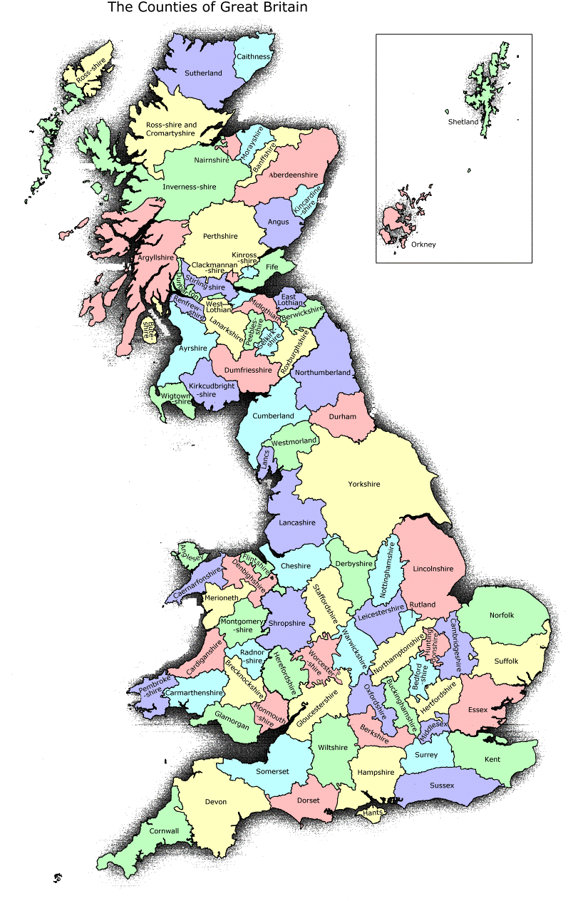
The map below represents the "old" counties, before Local Government reorganisation in the 1970's.
18th - 20th century records are usually stored by the old county
system.
For example, the old county of Berkshire has been split into
several Unitary Authorities. Nevertheless, "Berkshire Records Office"
still exists and holds the old documents.
Even older records may turn up in strange places; once, "detached" parts
of counties were common.
Example; Wokingham in east Berkshire was once
part of Wiltshire - an odd arrangement resulting from how the lands were
granted by the monarch. So very old Wokingham records must be sought in
Wiltshire Records Office. Most RO's are very good at cross-indexing
these anomolies though.
| Index |