In the same manner as with page2.html, and supplementary to it, this study of winter monsoon clouds
follows earlier collaboration with Joanne and Robert Simpson at the University of Virginia. This page
shows various interesting cloud formations, notably "slender" cumulus humilis (Warner 1982). This
was an error; the cumulus were narrow rather than slender, and the semantic error is now
corrected. Slides by Joanne and Robert Simpson together with Warner's black and white film have been used
here. A weak vortex disturbance occurred off Borneo on 16 and 17 December. One may go straight to the
findings of this study.
(back to main page).
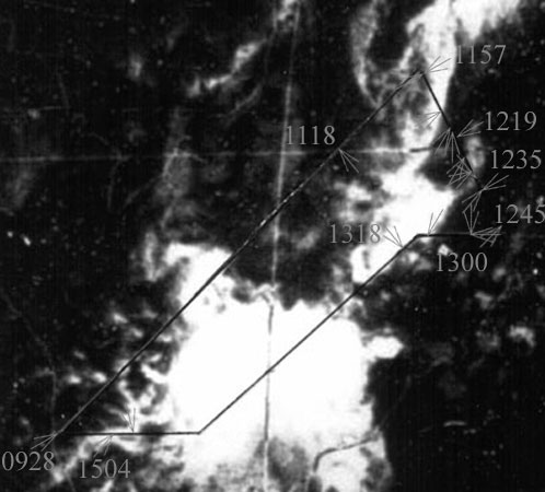
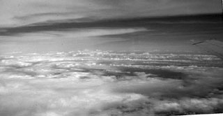
After much flight near stratus layers and above shallow cumulus, an overcast was briefly encountered
below flight level:
1118. about 10.1°N, 111.4°E, altitude 6.8 km on 320° azimuth.
(back)
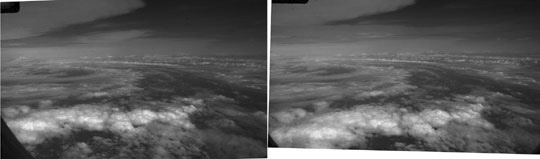
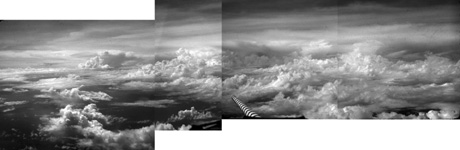
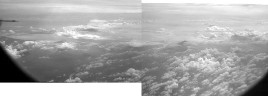
At the northern extremity of the aircraft track conditions remained undisturbed with many layers of cloud:
1157. 11.9°N, 113.8°E, altitude 7.4 km on 060° (left) and 240° (right) azimuth.
(back)
1209. 10.8°N, 114.4°E, alitude 7.4 km on 060° azimuth.
Lines of small cumulus aligned roughly N-S, mostly confined below the level of stratus.
(back)
1216. 10.4°N, 114.7°E, altitude 7.4 km on 030° azimuth.
Cumulus confined below the level of stratus, and arcs of stratiform cloud oriented towards the east.
(back)
1218. 10.3°N, 114.8°E, altitude 7.4 km looking N.
Looking back on arc seen above.
(back)
1219. 10.2°N, 114.8°E, altitude 7.4 km on 240° azimuth.
Cumulus humilis at quite large number density were sheared towards azimuth 330, indicating relative
winds below this level from the opposite direction.
The coastline of an atoll may be seen in the middle of Joanne's view.
(back)
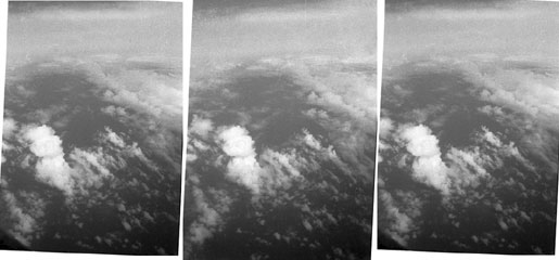
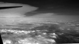
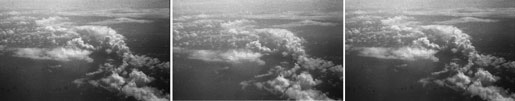
1225. 9.7°N, 115.1°E, altitude 7.4 km on 030° azimuth.
Narrow small cumulus sheared towards the north. From the narrow widths, unstable stratification
and an absence of subsidence at the level of the clouds is inferred. Note (in stereo) the
presence of stratus between the top of the largest cumulus and flight level.
(back)
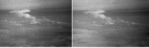
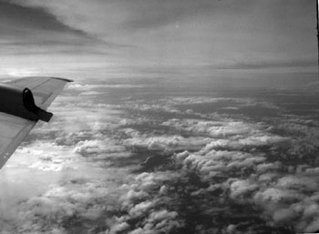
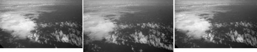
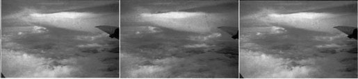
1229. 9.4°N, 115.3°E, altitude 7.4 km on 060° azimuth.
Note the evident feebleness and intermittency of cumulus updrafts, and the arrest of ascent at a
stable layer where the cloud is spread out.
(back)
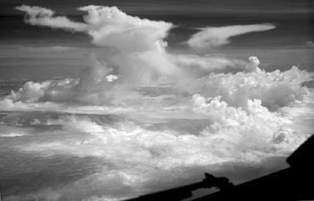
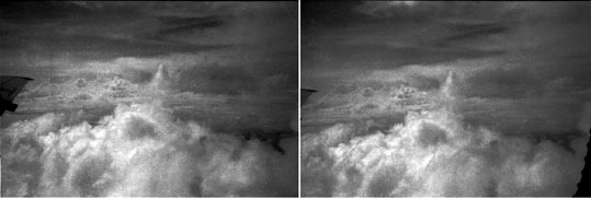
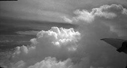
1230. 9.3°N, 115.3°E, altitude 7.4 km on 140° azimuth.
By RHS from the cockpit. The anvil was towards roughly azimuth 250. Note the absence of marked
wind shear through flight level:
local cumulus towers were nearly vertical.
(back)
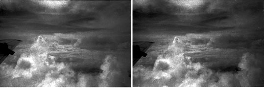
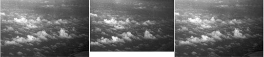
1235.05. 8.9°N, 115.55°E, altitude 7.4 km on 240° azimuth.
The top of a cumulus evaporating at flight level. The last remnant of updraft may be perceived,
with fallout below.
Cumulus were rising gently through unstable stratification.
(back)
1235.09. 8.9°N, 115.55°E, on 240° azimuth.
The same view taken a few seconds later. The interval between right and left eye views was minimal,
about a second.
1239. 8.65°N, 115.7°E, altitude 7.4 km on 040° azimuth.
A small patch of narrow cumulus humilis, denoting locally an absence of subsidence accompanying
unstable stratification.
The humilis were sheared towards about azimuth 050, indicating a low level wind maximum from 050.
(back)
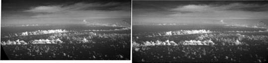
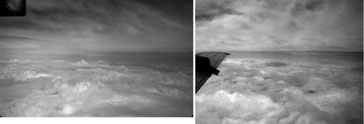
1245. 8.3°N, 116°E, altitude 7.4 km on 045° azimuth.
Photos by Joanne Simpson. Linear features of narrow cumulus fractus and humilis.
Winds were not strong near the surface.
Note the areas with a total absence of cumulus. The tall congestus was very roughly 70 km distant.
(back)
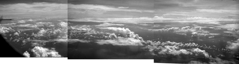
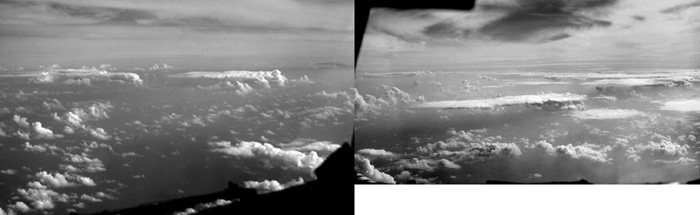
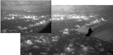
1300. 8°N, 115.2°E, altitude 7.8 km on 180° azimuth. Left half of pan by RHS.
1300. 8°N, 115.2°E, on 270° azimuth. Right half of pan by RHS. Strong ascent.
(back)
1301. 8°N, 115.2°E, altitude 7.8 km on 160° azimuth.
1310. 8°N, 114.3°E, altitude 7.8 km on 210° azimuth.
Strong ascent.
(back)
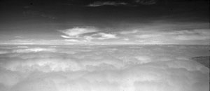
1318. 7.7°N, 113.6°E, altitude 7.8 km on 140° azimuth.
Quite a thick anvil at altitudes through flight level.
(back)
Much of the return part of the flight was in cloud, with no photos taken.
1455. 3.5°N, 106°E, altitude 7.8 km .
Pan from cockpit by RHS. On azimuth 165° (150 left and 180 right).
Streets are of orientation 230 - 050°
and suggest relatively strong winds from 050° at low levels.
(back)
1504. 3.4° N, 105.4° E, altitude 7.8 km on 040° azimuth.
Similar to the view following, a difficult partial cross-eye stereo-pair between a color slide by RHS and
black and white film by Warner.
Taken at the time of a loop for tests of wind measurement.
(back)
(back to main page) (back to web
design)
1506. 3.5°N, 105.6°E, altitude 7.8 km on 030° azimuth.
Near the surface, streets were aligned along 320-140°, probably close to the wind orientation.
Rows of narrow humilis were aligned along 290-110°. The tops of the cumulus humilis were sheared
towards 330°, implying relative flow from this direction.
Several instances have been shown here of narrow cumulus humilis, stemming from shallowness of roots in the sub-cloud layer. This appears to accompany both unstable stratification and an absence of subsidence. Systematic search for appearances of narrow cumulus humilis has shown no particular circumstances of occurrence. They appeared occasionally on nearly every mission in WMONEX. There is a variety of mechanisms of response to forcings on larger scales. (back to main page)